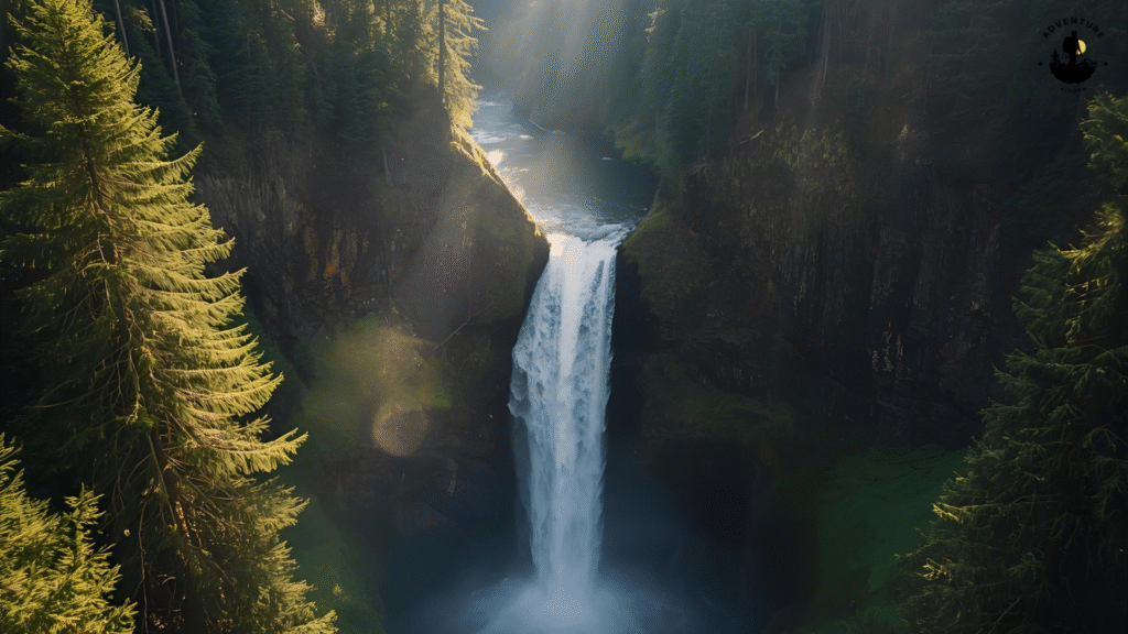
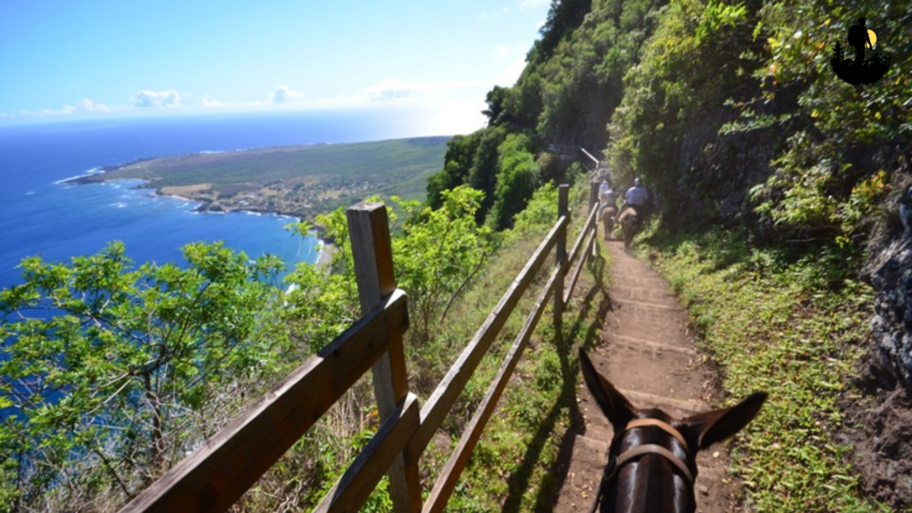
America’s Most Remote & Untouched Landscapes
There are some corners of America where silence feels sacred, where the rhythm of nature is uninterrupted, and where the modern world fades into the background. These places are not defined by crowds or convenience but by vastness, solitude, and raw beauty. They are landscapes shaped by time, weather, and geological forces rather than human hands. Exploring such destinations is not simply about sightseeing. It is about slowing down, reconnecting with the earth, and remembering what it feels like to stand somewhere truly wild.

From mist-draped waterfalls hidden deep in forests to deserts that stretch endlessly beneath star-filled skies, America offers an extraordinary variety of untouched terrain. Each of these places carries its own spirit, mood, and story. Some feel gentle and soothing, while others feel powerful and humbling. Together, they form a collection of landscapes that reveal the true depth and diversity of the country’s natural heritage.
Below are some remote landscapes usa, each offering an unforgettable experience for travelers who seek solitude, authenticity, and wonder.
America’s Remote & Untouched Landscapes
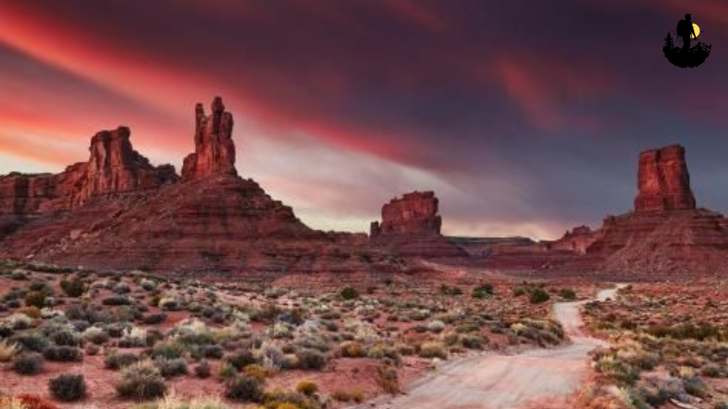
Valley of the Gods, Utah
Valley of the Gods Utah stretches across a vast expanse of red earth and towering sandstone formations, creating a landscape that feels ancient and untouched. Unlike nearby Monument Valley, this area remains largely undeveloped, with only a simple dirt road winding through the valley. There are no large visitor centers, no fences, and no crowds. Just open land and endless sky.
Massive rock buttes rise dramatically from the desert floor, their surfaces carved by wind and rain over millions of years. At sunrise, the formations glow soft pink and orange. By midday, they deepen into rich shades of red and rust. At sunset, the entire valley seems to ignite with color, while shadows stretch long across the ground.
Walking through Valley of the Gods feels like stepping into another time. The silence is profound. You can hear your own footsteps, the whisper of wind, and occasionally the distant call of a bird. The vastness of the landscape creates a powerful sense of perspective, reminding visitors how small they are within the grand scale of nature.
The valley also holds deep cultural significance. The land is part of Navajo Nation territory, and many of the rock formations have spiritual meaning. This adds a layer of reverence to the experience, encouraging visitors to move with respect and awareness.
At night, Valley of the Gods becomes something truly extraordinary. With almost no light pollution, the sky fills with stars from horizon to horizon. The Milky Way stretches overhead like a glowing river of light. Sitting beneath this sky, surrounded by silent stone giants, feels both humbling and deeply peaceful.
Coordinates: Approximate location 37.2750° N, 109.8650° W
Best Photography Spots:
- Roadside pull-offs at sunrise and sunset
- Wide-angle desert panoramas
- Night sky compositions
Why It Is So Special
- It offers raw desert beauty without commercialization, allowing visitors to experience the land in its purest form.
Weather: Hot summers, cool nights
Best Season: Spring and fall
Budget: $50 to $120 per night nearby
Best Food Nearby: Navajo tacos, green chili stew
Best Places to Stay: Primitive camping, small motels in Mexican Hat
Valley of the Gods stretches across a vast expanse of red desert in southeastern Utah, where towering sandstone monoliths rise from the earth like ancient guardians. The moment you enter the valley, a sense of stillness settles in. There are no entrance booths, no crowded parking lots, and no paved roads. Instead, a winding dirt track leads through an open landscape shaped by millions of years of wind, rain, and time. The absence of modern infrastructure enhances the feeling that you have stepped into a place largely untouched by the present.
The rock formations vary in size and shape, from slender spires to massive buttes that dominate the horizon. Each structure carries unique textures and layers, revealing the geological history of the region. As sunlight moves across the sky, colors shift dramatically. Early mornings bring soft pinks and pale oranges. By midday, deep reds and rust tones take over. At sunset, the valley glows with fiery intensity, while long shadows stretch across the desert floor, creating striking contrasts.
Walking through Valley of the Gods is an exercise in quiet observation. The silence feels vast, broken only by the whisper of wind brushing against stone or the crunch of gravel beneath your boots. Occasionally, you may spot a lizard darting between rocks or a raven circling overhead. The wide-open space encourages slow exploration. Many visitors choose to drive the loop road and stop at various points, while others venture out on foot to experience the terrain more intimately.
Beyond its physical beauty, the valley holds deep cultural significance. The land lies within the Navajo Nation, and many of the formations are connected to stories and spiritual beliefs passed down through generations. This cultural presence adds an invisible but powerful layer to the experience, reminding visitors that the valley is not just scenery, but a sacred landscape.
As night falls, Valley of the Gods transforms into one of the best stargazing locations in the American Southwest. With almost no light pollution, the sky fills with countless stars. The Milky Way stretches overhead in a luminous arc, and shooting stars are common. Sitting beneath this immense sky, surrounded by silent stone towers, creates a feeling of profound humility and peace.
Coordinates: Approximate location 37.2750° N, 109.8650° W
Best Photography Spots:
- Roadside pull-offs along the loop road
- Wide-angle desert panoramas
- Night sky compositions with rock silhouettes
Why It Is So Special
- Valley of the Gods offers raw desert beauty without crowds or commercialization. It provides a rare opportunity to experience the American Southwest in its purest and most tranquil form.
Weather: Hot summers, cool nights, mild winters
Best Season to Visit: Spring and fall
Budget: $50 to $120 per night nearby
Best Food Nearby: Navajo tacos, green chili stew, roadside diners
Best Places to Stay: Primitive camping, small motels in Mexican Hat, simple lodges
Kalaupapa Peninsula, Hawaii
Kalaupapa Peninsula rests quietly at the base of some of the tallest sea cliffs in the world, creating a setting that feels both isolated and deeply moving. Located on the island of Molokai, this remote peninsula is accessible only by a steep hiking trail, a small aircraft, or by boat when ocean conditions are calm. The journey itself becomes part of the experience, slowly separating visitors from the noise and pace of everyday life.
As you arrive, the dramatic scale of the landscape immediately captures your attention. Sheer cliffs tower thousands of feet above grassy plains that stretch toward the ocean. The Pacific surrounds the peninsula in shifting shades of blue and turquoise, with waves rolling gently onto rocky shores and hidden coves. The air is thick with the scent of salt and wild vegetation, while seabirds glide effortlessly along the cliffs.
Kalaupapa is not only a place of extraordinary natural beauty, but also one of deep historical and cultural importance. For more than a century, it served as a settlement for people affected by Hansen’s disease. Many of their homes, churches, and cemeteries still remain, carefully preserved. Walking through these quiet spaces creates a powerful sense of respect and reflection, reminding visitors that the land holds human stories as well as natural wonders.
The natural environment here remains remarkably pristine. Native plants thrive across the peninsula, and marine life flourishes in the surrounding waters. Dolphins are often spotted offshore, and humpback whales migrate past Molokai during winter months. Inland, gentle breezes move through tall grasses, and the only sounds are wind, waves, and distant bird calls.
Sunrise and sunset at Kalaupapa are unforgettable. Morning light paints the cliffs in soft gold and peach tones, while evenings bring deep purples and fiery oranges to the sky. The changing light transforms the entire landscape, offering endless opportunities for photography and quiet contemplation.
Coordinates: Approximate location 21.1870° N, 156.9850° W
Best Photography Spots:
- Clifftop overlooks
- Coastal trail viewpoints
- Rocky shoreline at dawn or dusk
Why It Is So Special
- Kalaupapa Peninsula combines dramatic scenery, profound history, and rare isolation. It is a place where nature and human resilience coexist in powerful harmony.
Weather: Warm year-round, occasional rain
Best Season to Visit: April to October
Budget: $120 to $250 per night
Best Food Nearby: Fresh fish, tropical fruits, poke bowls
Best Places to Stay: Small inns and guesthouses on Molokai
North Cascades National Park, Washington
North Cascades National Park feels like a hidden realm of jagged peaks, deep valleys, and endless layers of wilderness. Often called the “American Alps,” this rugged region contains more glaciers than any other national park in the lower forty-eight states. Yet despite its extraordinary beauty, it remains one of the least visited major parks in the country, preserving a rare sense of solitude.
From the moment you enter the park, towering mountains dominate the skyline. Sharp ridgelines rise dramatically above dense evergreen forests, while waterfalls tumble down steep cliffs into rocky basins below. The air is crisp and clean, carrying the scent of pine, fir, and cold stone. Even in summer, traces of snow linger at higher elevations, reminding visitors of the harsh yet majestic environment that defines this landscape.
Hiking through North Cascades feels like stepping into a living postcard. Trails wind through old-growth forests, along crystal-clear streams, and into alpine meadows bursting with wildflowers. Lupine, paintbrush, and avalanche lilies add splashes of color against a backdrop of rock and ice. Many routes climb steadily toward high passes, where sweeping views stretch across dozens of peaks and distant valleys.
Wildlife thrives in this remote environment. Mountain goats are often spotted navigating steep cliffs with ease. Black bears roam forested slopes, while marmots sun themselves on rocky ledges. The stillness of the park makes every wildlife encounter feel special, as though you are a quiet guest in an ancient world.
One of the most striking features of North Cascades is its abundance of pristine lakes. Diablo Lake, with its vivid turquoise water, stands out as one of the most photographed spots in the park. The color comes from glacial silt suspended in the water, giving it an almost unreal appearance. Other lakes, tucked deeper into the backcountry, offer mirror-like reflections of surrounding peaks.
As evening approaches, the park grows even quieter. The wind softens, and the sky shifts through layers of pink, orange, and deep blue. Camping beneath these mountains allows you to experience a profound sense of isolation, broken only by distant animal calls or the gentle rush of a nearby stream.
Coordinates: Approximate location 48.7000° N, 121.2000° W
Best Photography Spots:
- Diablo Lake Overlook
- Cascade Pass Trail
- Ross Lake shoreline
- High alpine meadows at sunrise
Why It Is So Special
- North Cascades offers dramatic alpine scenery combined with true solitude. It is a place where visitors can experience wilderness on a grand scale without crowds.
Weather: Cool summers, heavy winter snow
Best Season to Visit: July to September
Budget: $70 to $180 per night
Best Food Nearby: Hearty mountain meals, soups, pies
Best Places to Stay: Rustic lodges, campgrounds, mountain cabins
Hoh Rain Forest, Washington
Entering the Hoh Rain Forest feels like stepping into another world. Thick green moss drapes over towering spruce and hemlock trees, hanging from branches like flowing curtains. Ferns blanket the forest floor in every direction, while fallen logs slowly decompose beneath layers of new growth. Everything here feels lush, alive, and timeless.
The air in the Hoh Rain Forest is cool and damp, carrying the earthy scent of wet leaves, bark, and soil. Soft light filters through the dense canopy, creating a muted, almost dreamlike atmosphere. Even on bright days, the forest remains shaded and calm, wrapped in a gentle stillness.
Trails wind through groves of ancient trees that have stood for hundreds of years. Some trunks are so wide that it takes several people holding hands to circle them. Walking among these giants creates a sense of humility. You become acutely aware of how small you are in comparison to the vast living history around you.
Wildlife quietly moves through the forest. Roosevelt elk often graze in open meadows, while owls perch silently in the branches above. The Hoh River flows along the edge of the forest, its pale blue water carrying glacial sediment from the distant mountains. Mist frequently rises from the river, adding to the mystical feel of the landscape.
One of the most enchanting aspects of the Hoh Rain Forest is its constant transformation. Rain is a regular presence, nourishing the ecosystem and deepening the vibrant greens. After rainfall, every surface glistens, and the forest seems to glow. The sound of raindrops tapping leaves becomes a soothing natural soundtrack.
Photographers are drawn to the Hoh for its textures and layers. Twisting tree roots, moss-covered branches, and winding trails provide endless composition opportunities. Early morning fog adds depth and atmosphere, making the forest feel even more otherworldly.
Coordinates: Approximate location 47.8600° N, 123.9340° W
Best Photography Spots:
- Hall of Mosses Trail
- Riverbank viewpoints
- Foggy forest paths
Why It Is So Special
- The Hoh Rain Forest is one of the finest examples of temperate rainforest in the world, offering a rare glimpse into an ecosystem that has remained largely unchanged for centuries.
Weather: Cool, rainy, misty
Best Season to Visit: Spring and summer
Budget: $80 to $200 per night
Best Food Nearby: Seafood, chowder, fresh bread
Best Places to Stay: Cabins near Forks, small lodges, forest cottages
Gates of the Arctic National Park, Alaska
Gates of the Arctic National Park represents wilderness in its purest form. There are no roads leading into the park, no developed campgrounds, and no visitor centers to welcome travelers. Instead, this immense landscape in northern Alaska exists exactly as nature intended. Mountains rise in endless layers, braided rivers carve through broad valleys, and tundra stretches toward the horizon in every direction. The feeling of remoteness is immediate and unmistakable.
Arriving here often requires a small bush plane, which lands on gravel bars or open tundra. From above, the scale of the park becomes clear. Vast, unbroken terrain spreads beneath you, untouched by human development. Once on the ground, the silence is profound. There is no distant traffic noise, no hum of civilization. Only wind, water, and the subtle sounds of wildlife.
The terrain varies dramatically. In some areas, sharp mountain peaks dominate the skyline. In others, gentle rolling hills covered in low shrubs and wildflowers extend for miles. During summer, the tundra bursts into color. Tiny purple, yellow, and white blossoms dot the ground, creating a delicate contrast against the rugged landscape. Rivers run cold and clear, reflecting massive skies and distant peaks.
Wildlife encounters are a defining part of the Gates of the Arctic experience. Caribou migrate through the park in large herds, moving steadily across the tundra. Grizzly bears roam river valleys in search of food. Wolves travel silently along ridgelines, while golden eagles soar overhead. Seeing these animals in their natural habitat reinforces the sense that humans are merely visitors here.
One of the most unique aspects of the park is the extreme variation in daylight. In summer, the sun barely dips below the horizon, creating long golden hours that seem to last forever. This constant light allows for extended exploration and breathtaking photography. In winter, darkness dominates, and the aurora borealis often dances across the sky in shimmering curtains of green and purple.
Spending time in Gates of the Arctic requires preparation, self-reliance, and respect for nature’s power. Weather can change quickly, and conditions are often harsh. Yet for those willing to embrace the challenge, the reward is an unmatched sense of freedom and connection.
Coordinates: Approximate location 67.7800° N, 153.3000° W
Best Photography Spots:
- River valleys with mountain backdrops
- High tundra ridges
- Midnight sun landscapes
Why It Is So Special
- Gates of the Arctic offers one of the last true wilderness experiences in North America, where nature remains completely in control.
Weather: Cold, unpredictable
Best Season to Visit: June to August
Budget: $150 to $350 per night (guided trips or lodges)
Best Food Nearby: Hearty Alaskan cuisine, fresh fish
Best Places to Stay: Wilderness lodges, guided expedition camps
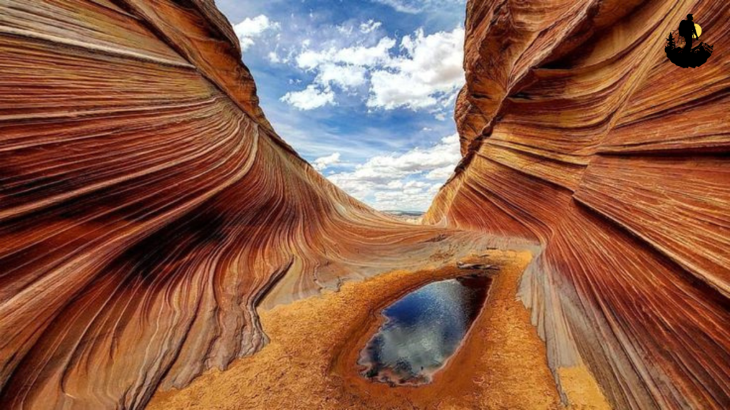
The Wave, Arizona
The Wave is one of the most visually striking landscapes in the American Southwest. Hidden within the remote Coyote Buttes North area near the Arizona-Utah border, this sandstone formation looks more like a piece of abstract art than a natural structure. Flowing bands of red, orange, yellow, and cream curve and twist across the rock, creating the illusion of frozen waves.
Reaching The Wave requires effort. Visitors must obtain a permit through a highly competitive lottery system, and then complete a challenging hike across open desert terrain. There are no clearly marked trails, and navigation skills are essential. This difficulty helps preserve the fragile environment and ensures that only a limited number of people experience the site each day.
The hike itself is part of the adventure. Rolling sandstone hills, narrow washes, and wide open desert stretch in every direction. Along the way, smaller rock formations display fascinating textures and colors, hinting at the wonders ahead. As you approach The Wave, the landscape begins to shift, revealing smoother surfaces and more dramatic curves.
Standing within The Wave feels surreal. The stone beneath your feet is cool and smooth, sculpted by centuries of wind and water. Every angle offers a new pattern, a new interplay of light and shadow. The formations change color depending on the time of day. Morning light produces soft, pastel tones, while afternoon sun intensifies the reds and golds.
Silence dominates the area. Without crowds or nearby roads, the only sounds are wind brushing across the rock and your own footsteps. Many visitors find themselves moving slowly, carefully, taking time to absorb every detail.
Coordinates: Approximate location 36.9950° N, 112.0060° W
Best Photography Spots:
- Main Wave formation
- Side alcoves
- Ridges overlooking the canyon
Why It Is So Special
- The Wave is a rare geological masterpiece, protected by strict access limits to preserve its fragile beauty.
Weather: Hot summers, cool winters
Best Season to Visit: Spring and fall
Budget: $80 to $180 per night nearby
Best Food Nearby: Southwestern cuisine
Best Places to Stay: Kanab hotels, desert lodges
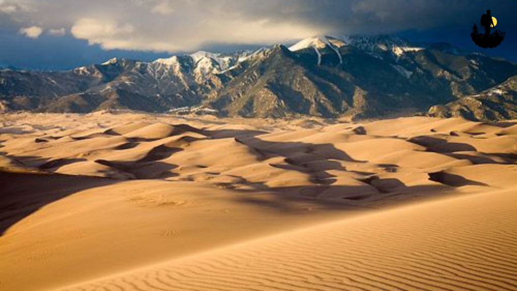
Great Sand Dunes National Park, Colorado
Great Sand Dunes National Park feels like a landscape born from imagination. Rising unexpectedly from the wide San Luis Valley, massive dunes tower against a backdrop of the rugged Sangre de Cristo Mountains. Some of these dunes reach heights of over 700 feet, making them the tallest in North America. The contrast between soft, golden sand and jagged, snowcapped peaks creates a scene that feels both surreal and awe-inspiring.
Approaching the dunes for the first time is unforgettable. What initially appears as a faint line on the horizon slowly transforms into a towering wall of sand. As you step onto the dunes, each footstep sinks slightly, reminding you that this environment is constantly shifting. Wind sculpts the surface into ripples and ridges, creating patterns that change daily.
Walking across the dunes is both challenging and meditative. Climbing steep slopes requires effort, but reaching the top rewards you with sweeping views across miles of sand and distant mountains. The vastness of the landscape encourages quiet reflection. There are no trees for shade, no buildings in sight, and very little sound beyond the wind and your own breathing.
The dunes are part of a diverse ecosystem. In spring, Medano Creek flows at the base of the dunes, creating a rare seasonal beach-like environment where visitors can wade and cool off. Surrounding grasslands, wetlands, and forests support a variety of wildlife, including deer, foxes, and numerous bird species.
Sunrise and sunset transform the dunes into a painter’s palette. Early morning light casts long blue shadows across the sand, while evening brings warm golden and orange tones. As darkness falls, the park becomes an excellent place for stargazing. With minimal light pollution, stars appear sharp and abundant.
Exploring Great Sand Dunes often feels like wandering through a living sculpture garden, where no two visits are ever the same.
Coordinates: Approximate location 37.7300° N, 105.5100° W
Best Photography Spots:
- High dune ridges at sunrise
- Medano Creek reflections
- Wide-angle mountain and dune compositions
Why It Is So Special
- Great Sand Dunes offers one of the most unusual landscapes in America, blending desert, alpine, and wetland environments in one place.
Weather: Hot summers, cool nights, cold winters
Best Season to Visit: Late spring and early fall
Budget: $70 to $160 per night
Best Food Nearby: Southwestern dishes, burgers, local cafes
Best Places to Stay: Campgrounds, lodges in Alamosa, rustic cabins
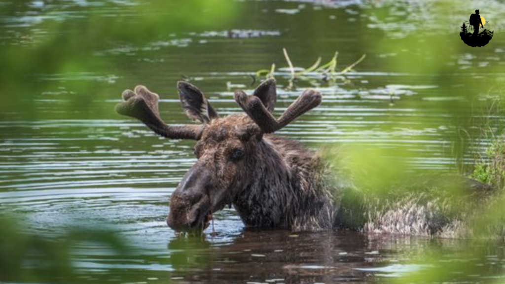
Isle Royale National Park, Michigan
Isle Royale National Park is a rugged, forested island in the middle of Lake Superior, far removed from the mainland and modern distractions. Accessible only by ferry, seaplane, or private boat, the park feels like a world apart. The journey across open water reinforces the sense that you are leaving civilization behind.
The island’s landscape is shaped by ancient volcanic activity, resulting in long ridges, rocky shorelines, and dense boreal forests. Inland lakes reflect the surrounding trees like mirrors, while narrow trails weave through thick woodland. The air smells of pine and freshwater, and the atmosphere feels calm and timeless.
Wildlife plays a central role in the Isle Royale experience. Moose wander freely across the island, often seen browsing near lakeshores or crossing trails. Wolves also inhabit the island, forming one of the most studied predator-prey relationships in the world. While wolves are rarely seen, their presence adds to the island’s wild character.
Hiking on Isle Royale is a quiet, immersive experience. Trails range from short coastal walks to multi-day backcountry routes. Many visitors choose to camp along remote lakes or near rocky shores, falling asleep to the gentle sound of waves lapping against stone.
The isolation of the island creates incredibly dark night skies. On clear nights, stars fill the heavens, and the Milky Way stretches vividly overhead. The occasional northern lights display adds an extra layer of magic.
Coordinates: Approximate location 48.1000° N, 88.5500° W
Best Photography Spots:
- Rocky Lake Superior shoreline
- Inland lake reflections
- Forest trails at dawn
Why It Is So Special
- Isle Royale offers a rare chance to experience a remote island wilderness where nature remains largely undisturbed.
Weather: Cool summers, cold winters
Best Season to Visit: June to September
Budget: $90 to $200 per night
Best Food Nearby: Simple lodge dining, packed trail meals
Best Places to Stay: Rock Harbor Lodge, campgrounds
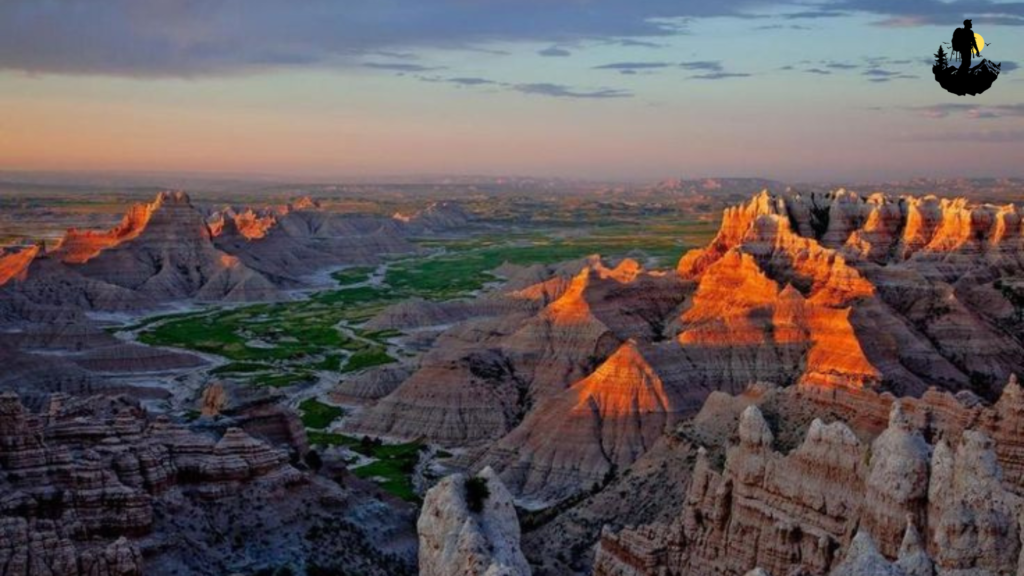
Badlands National Park, South Dakota
Badlands National Park feels like stepping into a vast natural painting. Layered rock formations stretch across rolling prairie in bands of soft pink, pale yellow, gray, lavender, and rust. Over millions of years, wind and water have carved the land into dramatic spires, deep canyons, and sharp ridges, creating a landscape that looks both fragile and powerful at the same time.
The first impression of the Badlands is often one of surprise. From a distance, the terrain appears harsh and barren, but as you explore further, subtle beauty reveals itself. Textured rock surfaces display intricate patterns, and hidden pockets of life thrive among the formations. Hardy grasses, wildflowers, and small shrubs cling to cracks in the stone, adding touches of green and color.
Driving through the park offers endless scenic viewpoints, each providing a different perspective of the layered terrain. Walking trails allow visitors to step directly into the heart of the Badlands, weaving between towering walls of rock and narrow corridors shaped by erosion. The silence here feels expansive, broken only by wind or the distant call of birds.
Wildlife is surprisingly abundant. Bison roam the surrounding grasslands in large herds, while bighorn sheep navigate steep cliffs with ease. Prairie dogs pop in and out of their burrows, filling the air with sharp chirps. Spotting these animals in such an open landscape adds to the sense of being part of a living ecosystem.
Sunrise and sunset transform the Badlands into a glowing canvas. Early morning light casts cool blue shadows across the formations, while evening brings warm oranges and deep reds. The constantly changing light makes each visit feel unique, even if you return multiple times.
At night, the park becomes exceptionally quiet. With little light pollution, the sky fills with stars. The Milky Way stretches overhead, creating a breathtaking contrast against the jagged silhouettes of the rock formations.
Coordinates: Approximate location 43.8554° N, 102.3397° W
Best Photography Spots:
- Big Badlands Overlook
- Door and Window Trails
- Notch Trail viewpoints
Why It Is So Special
- The Badlands showcase nature’s artistic side, revealing how erosion can create beauty from destruction.
Weather: Hot summers, cold winters, windy
Best Season to Visit: Spring and fall
Budget: $70 to $160 per night
Best Food Nearby: Classic American diners, buffalo burgers
Best Places to Stay: Lodges in Wall, campgrounds, rustic cabins
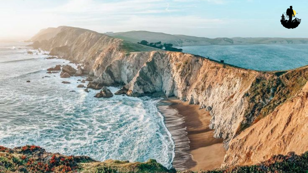
Point Reyes National Seashore, California
Point Reyes National Seashore is a place where rugged coastline meets rolling green hills, creating a landscape that feels wild, windswept, and wonderfully remote despite its proximity to major cities. Located north of San Francisco, Point Reyes offers more than 70,000 acres of protected land filled with cliffs, beaches, forests, and open grasslands.
The coastline is the heart of Point Reyes. Dramatic cliffs drop straight into the Pacific Ocean, where waves crash against rocks far below. Sea mist drifts inland, carrying the salty scent of the ocean. On foggy mornings, the cliffs fade into a soft gray haze, giving the area a mysterious, almost otherworldly atmosphere.
Hiking trails lead along ridgelines, down to secluded beaches, and through quiet forests of Douglas fir and coastal scrub. The diversity of terrain makes exploration endlessly rewarding. You might start your day walking beside crashing surf and end it wandering through peaceful meadows dotted with wildflowers.
Wildlife sightings are common. Tule elk roam freely across open fields. Harbor seals haul out on sandy shores. Gray whales migrate past the coastline during winter and spring, often visible from cliffside viewpoints.
One of the most iconic landmarks is the Point Reyes Lighthouse, perched dramatically on a rocky headland. Reaching it requires descending a long staircase, but the views of the endless ocean are well worth the effort.
Sunset at Point Reyes is unforgettable. The sky often glows with shades of orange, pink, and purple, while waves continue their rhythmic dance below. The combination of ocean, wind, and open space creates a feeling of freedom that lingers long after you leave.
Coordinates: Approximate location 38.0690° N, 122.8069° W
Best Photography Spots:
- Point Reyes Lighthouse
- Tomales Point Trail
- Chimney Rock
Why It Is So Special
- Point Reyes offers true coastal wilderness with incredible biodiversity and dramatic scenery.
Weather: Cool, windy, often foggy
Best Season to Visit: Spring and fall
Budget: $90 to $200 per night
Best Food Nearby: Fresh seafood, clam chowder, artisanal bread
Best Places to Stay: Inns in Point Reyes Station, coastal cottages

Tips for Visiting Remote & Untouched Landscapes
Plan your trip far in advance
Remote destinations often have limited access, seasonal road closures, permit requirements, or transportation constraints. Research entry rules, trail conditions, and weather patterns well before you go. Having a clear plan reduces risks and ensures you make the most of your time.
Carry more supplies than you think you need
Food, water, first-aid kits, and extra clothing are essential in isolated areas. Weather can change suddenly, and nearby stores may not exist. Packing extra calories, emergency rations, and hydration can make a critical difference.
Download offline maps and navigation tools
Cell service is unreliable or nonexistent in most remote landscapes. Use GPS devices, paper maps, and offline navigation apps to avoid getting lost. Knowing how to read a map and compass is also highly recommended.
Tell someone your itinerary
Share your planned route, destination, and return time with a trusted person. If something goes wrong, this information can help search and rescue teams locate you faster.
Respect wildlife and keep your distance
Never approach, feed, or attempt to photograph animals at close range. Observing wildlife from afar protects both you and the animals. Store food properly to avoid attracting wildlife to your campsite.
Follow Leave No Trace principles
Pack out all trash, stay on designated trails, avoid picking plants, and minimize campfire impact. Preserving these places ensures future visitors can experience the same pristine landscapes.
Dress in layers and prepare for changing weather
Temperatures can fluctuate dramatically, even within a single day. Layered clothing allows you to adjust comfortably as conditions change.
Start early in the day
Morning hours often provide calmer weather, better lighting for photography, and fewer people on trails. Early starts also give you extra time in case plans change.
Use proper footwear and gear
Sturdy hiking boots, trekking poles, and weather-resistant clothing improve safety and comfort. A headlamp, extra batteries, and multi-tool are also valuable additions.
Move slowly and stay mindful
Remote landscapes reward patience. Take time to observe your surroundings, listen to natural sounds, and appreciate small details. Slowing down enhances both safety and enjoyment.
Know your limits
Choose hikes and activities that match your physical ability and experience level. Pushing too hard in remote terrain can increase the risk of injury.
Respect local cultures and regulations
Some landscapes hold deep cultural or spiritual significance. Follow posted rules, permit systems, and local guidelines with care and respect.
Final Words
America’s most remote and untouched landscapes remind us that true beauty often exists far from noise, crowds, and convenience. These places teach patience, humility, and respect for the natural world. Standing beneath towering mountains, beside silent deserts, or along wild coastlines reconnects us to something deeper and timeless. Each journey into these quiet spaces becomes more than travel. It becomes a personal encounter with the earth itself. By exploring responsibly and mindfully, we help preserve these fragile environments so future generations can experience the same wonder, stillness, and sense of awe that these extraordinary landscapes inspire.
✦ Related Articles You May Love
- Living Like A Local In Remote U S Regions
- Hidden Homestay Experiences In Offbeat U S Towns
- Folklore And Legends From The Deep South
- How To Find Hidden Adventure Spots Across The Usa
- Essential Packing Tips For U S Hiking Trips
- Budget Travel Hacks For Exploring U S Trails
- Safety Tips For Hiking Hidden Trails In The Usa
- Best Seasons To Visit Hidden U S Parks
- Eco Friendly Ways To Explore Remote U S Destinations
- How To Reach Hard To Access U S Adventure Spots
- Navigating Road Trips To Lesser Known U S Parks
- Apps That Reveal Hidden Trails And Campsites
- How To Stay Connected In Remote U S Areas
- Capturing Hidden Landscapes Of The American West
- Capturing Hidden Motion Long Exposure Photography In U S National Parks
- Night Sky Photography In Americas Dark Sky Parks
- Photo Walks Through Hidden U S Small Towns
- Reflections Photography On Hidden U S Lakes
- Rock Climbing In Lesser Known U S Spots
- Trail Running Through Hidden Forest Paths
- Mountain Biking Adventures In The Pacific Northwest
- Paragliding Above Secret U S Peaks
- Scuba Diving Hidden Reefs In The Florida Keys
- Abandoned Ghost Towns In The American West
- Hidden Architectural Gems Across The Usa
- Discovering Truly Local Favourite Hiking Trail Usa
- Travel Mistakes To Avoid On U S Hidden Trails
- Solo Adventures In Remote U S Locations
- How Tourism Is Changing Hidden American Spots
- Hidden U S Destinations That Inspired Great Art
- Americas Forgotten Ghost Stories And Legends
- Short Hidden Hikes Under 5 Miles In The Usa
- Abiqua Falls Oregons Most Hidden Waterfall In The Pacific Northwest
- Exploring Hidden Islands In The Florida Keys
- Hidden Trails Secret Canyons Offbeat Hiking Escapes In The American Southwest
- Lesser Known National Parks Usa Hidden Gems To Explore In 2025
- Secret Caves To Explore In The Appalachian Mountains
- A Bloomseekers Paradise The Wildflower Trails In The Rocky Mountains
- Scenic Mountain Passes Few Know In Colorado Hidden And Adventurous Places You Must Explore
- Kayaking Through Hidden Rivers Of The South
- Underrated Desert Oases In The Southwest Usa
- Seasonal Hidden Wonders In U S National Parks
- Hidden Hot Springs In The Western United States Your Guide To Real Relaxation
- Snow Covered Winter Trails No One Talks About
- Secret Coastal Cliffs To Explore In California
- Underground Crystal Caves In The United States
- Untouched Forest Sanctuaries In The Northeast
- Stories From Rural Americas Forgotten Communities
- Hidden Artisan Markets In The Midwest Your Ultimate Guide
- Local Foods Found Only In Small Town America
🌿 Sources & References
- Travel & Adventure – National Geographic
- Outdoor Recreation – REI Expert Advice
- Leave No Trace Principles
- Nature Conservation – WWF
- U.S. National Parks – NPS
- Sustainable Tourism – UNWTO
- Wilderness Safety – American Red Cross
- Outdoor Health Benefits – NIH
- Travel Health – CDC
- Ecotourism – The International Ecotourism Society