Hidden Cultural Trails & Heritage Routes in the USA
Traveling through the United States is not only about famous cities and national parks. Beyond the well known attractions, there are cultural trails and heritage routes that quietly preserve the stories, traditions, and landscapes that shaped the country. These paths guide travelers through historic towns, Indigenous lands, colonial settlements, and artistic communities where culture feels alive rather than displayed behind glass.
Walking or driving along these routes offers a deeper connection to local history, allowing visitors to experience regional food, architecture, music, and traditions that many tourists miss. Hidden heritage trails invite slow exploration. They encourage travelers to listen to stories told by landscapes, museums, and local residents who keep traditions alive. From centuries old trading routes to scenic byways linking historic landmarks, these journeys blend history with natural beauty. If you are looking for meaningful travel experiences that feel authentic and immersive, these lesser known travel routes reveal a side of America that feels both timeless and deeply personal.
Exploring Hidden Heritage Paths in the USA
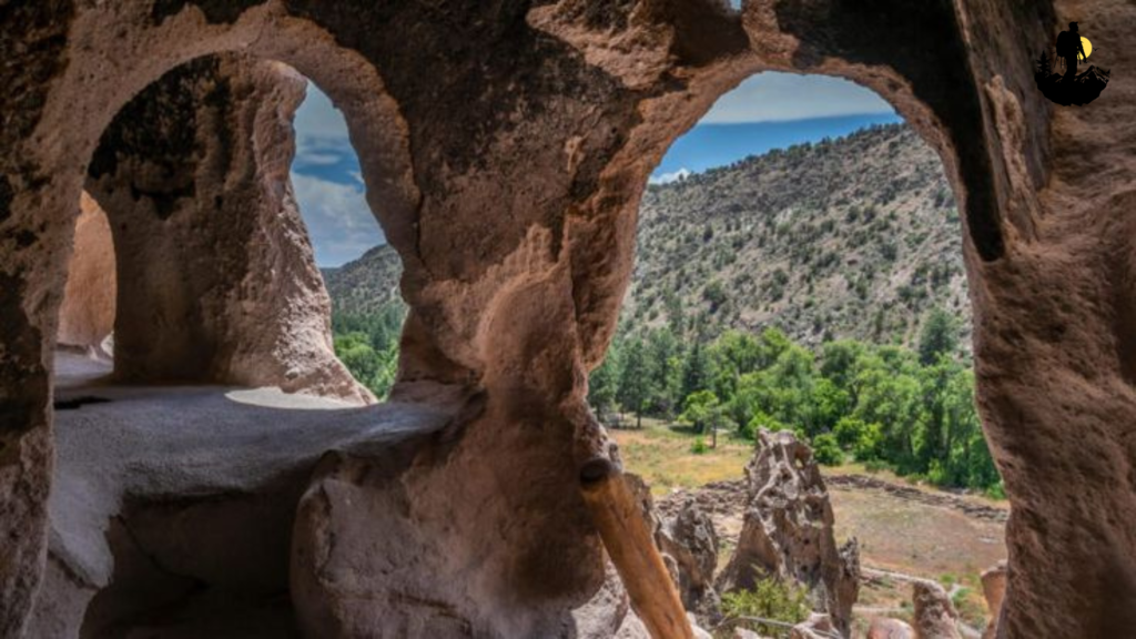
El Camino Real de Tierra Adentro, New Mexico
El Camino Real de Tierra Adentro carries a quiet sense of history that stretches back centuries. This ancient route once connected Mexico City to northern New Mexico, serving as a lifeline for trade, culture, and migration. Today, sections of the trail weave through desert landscapes, historic pueblos, and old Spanish colonial settlements that feel preserved in time. Driving along the route feels like stepping into a living history book where adobe churches stand against endless skies and cottonwood trees line the Rio Grande.
Early mornings along the trail are especially peaceful. The desert air feels cool and still, and the golden sunlight slowly illuminates distant mesas. Small villages appear unexpectedly, each one carrying stories shaped by Indigenous traditions and Spanish influence. Handcrafted pottery, woven textiles, and local markets reflect a culture that has evolved but never forgotten its roots.
Walking through historic plazas, you may hear church bells echo across the valley or see artists painting scenes inspired by centuries old architecture. The route is not just about movement from one place to another. It is about understanding how landscapes shape identity. Many travelers describe the experience as grounding, as if the vast desert invites reflection while every stop reveals another layer of heritage.
Coordinates: Approximate location 35.6869° N, 105.9378° W near Santa Fe, New Mexico
Best Photography Spots:
- Historic adobe missions: Capture warm earth tones glowing during golden hour.
- Rio Grande viewpoints: Frame the river against wide desert horizons for dramatic contrast.
- Old trading posts: Rustic wooden textures create timeless compositions.
- Village plazas: Early morning shots show soft light and quiet streets without crowds.
- High desert overlooks: Wide angle lenses emphasize the vastness of the landscape.
Using natural light works best here. The desert’s changing colors during sunrise and sunset create soft shadows and warm tones that highlight the cultural architecture.
Why It Is So Special
- El Camino Real de Tierra Adentro is more than a scenic drive. It is a corridor of memory where cultures blended and shaped the American Southwest. Unlike busy tourist routes, it invites slow travel and meaningful stops. Each mission church and historic village tells a story of resilience and tradition. Travelers often find themselves connecting deeply with the land, learning about Indigenous heritage alongside Spanish colonial history. The trail encourages reflection, reminding visitors that history is not distant but still present in everyday life.
Weather: Warm sunny days, cool desert nights
Best Season to Visit: Fall and spring when temperatures are comfortable
Budget: $70 to $160 per night nearby
Best Food Nearby: New Mexican cuisine, green chile stew, blue corn enchiladas at local cafes
Best Places to Stay: Adobe style inns in Santa Fe, small desert casitas, historic bed and breakfasts
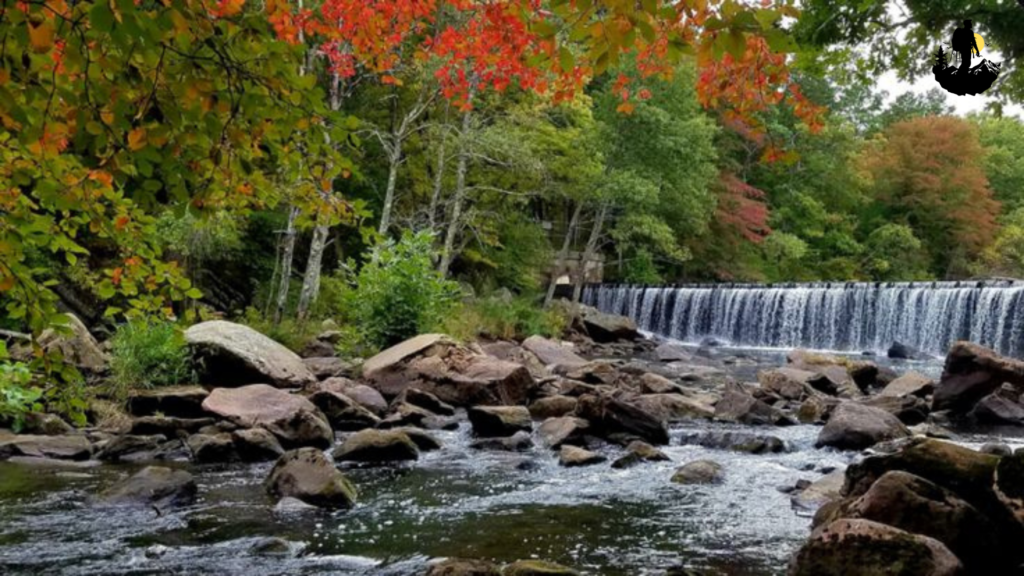
Natchez Trace Parkway, Mississippi to Tennessee
The Natchez Trace Parkway feels like a journey through layers of American history woven into a peaceful scenic drive. Once used by Native American traders, early settlers, and travelers returning north after selling goods in Natchez, the route now stretches through forests, rolling hills, and historic landmarks that reveal stories of exploration and cultural exchange. Driving here feels calm and unhurried. There are no billboards or heavy commercial development, only winding roads shaded by tall trees and quiet historical markers waiting to be discovered.
Morning fog often drifts across the fields, giving the landscape a soft, cinematic atmosphere. As the day unfolds, sunlight filters through hardwood forests, illuminating wooden bridges and open meadows. Travelers may encounter preserved mounds built by ancient Indigenous cultures or stop at interpretive centers that share stories of early American life. The parkway encourages slow travel. Pull off areas invite picnics, short walks, and moments of stillness where you can hear birds calling across the valley.
Local towns along the route offer warm Southern hospitality. Small diners serve traditional comfort food, and historic inns welcome visitors with front porches that overlook quiet countryside views. Many travelers describe the experience as restorative, as if the pace of the road allows them to reconnect with history and nature at the same time.
Coordinates: Approximate location 34.3176° N, 88.7034° W near Tupelo, Mississippi
Best Photography Spots:
- Cypress swamps: Early morning reflections create moody, atmospheric images.
- Historic wooden bridges: Symmetrical compositions work beautifully here.
- Indigenous mound sites: Wide shots capture the scale of these ancient landmarks.
- Sunset overlooks: Soft golden light enhances rolling hill landscapes.
- Forest trails: Long pathways framed by trees create depth and storytelling imagery.
A tripod helps capture soft forest lighting and smooth long exposure shots, especially during sunrise or foggy mornings.
Why It Is So Special
- The Natchez Trace Parkway stands out because it blends natural beauty with cultural history in a quiet, respectful way. Instead of crowded tourist stops, the trail offers space to slow down and absorb the stories carried by the land. From Indigenous heritage to early American travel routes, every mile feels layered with meaning. Many visitors find the journey emotionally calming, as the rhythm of the road and the absence of urban noise create a rare sense of peace.
Weather: Mild springs, warm summers, colorful autumn seasons
Best Season to Visit: Late spring and fall for comfortable weather and vibrant scenery
Budget: $65 to $140 per night nearby
Best Food Nearby: Southern barbecue, fried catfish, homemade biscuits at roadside diners
Best Places to Stay: Historic inns in Natchez, countryside cabins, boutique lodges near Tupelo
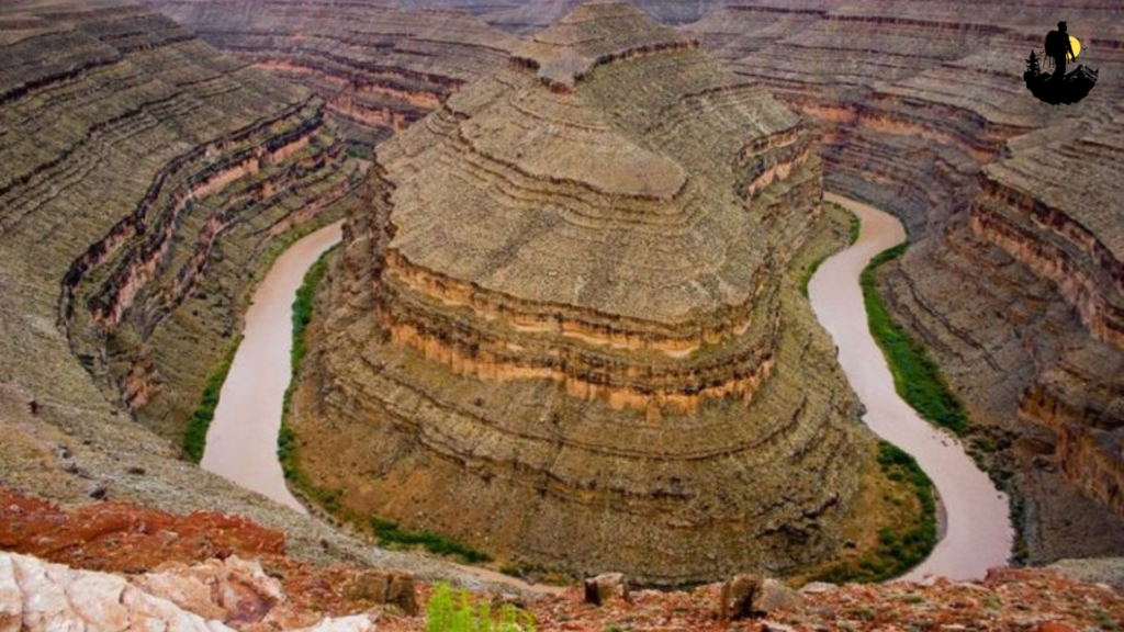
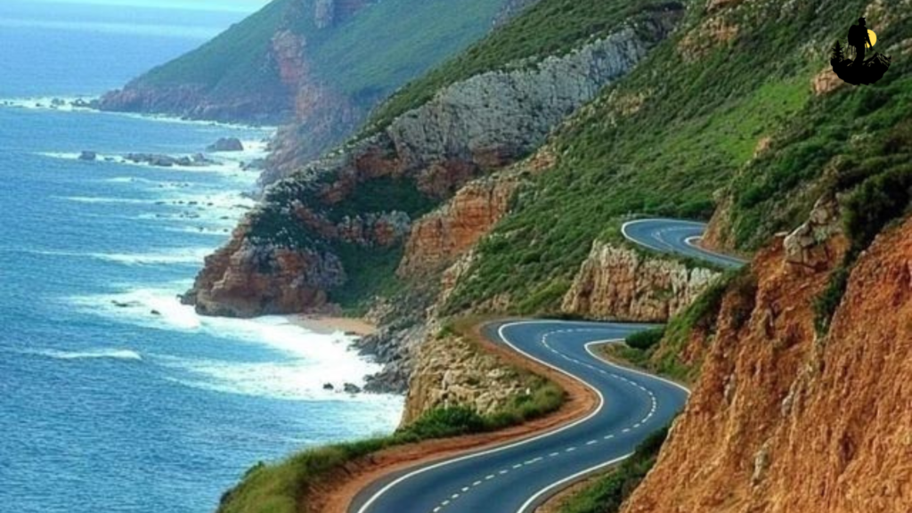
Trail of the Ancients Scenic Byway, Colorado and Utah
Trail of the Ancients Scenic Byway feels like stepping into a vast open air museum where ancient cultures, desert landscapes, and sacred stories exist side by side. This cultural route winds through the Four Corners region, connecting archaeological sites, cliff dwellings, and ancestral Puebloan landscapes that stretch across rugged mesas and deep canyons. The road itself moves slowly through red rock formations and high desert plateaus, inviting travelers to pause often and absorb the history carried by the land.
At sunrise, the sandstone cliffs glow in warm shades of orange and gold. The silence of the desert feels almost spiritual, broken only by wind moving across the mesas or the distant call of ravens overhead. Many visitors begin their journey near Cortez, where small museums and cultural centers introduce the heritage of Indigenous communities whose traditions continue today. As you drive further along the byway, ancient structures appear carved into cliff faces, blending seamlessly with the rock as if they were always meant to be part of the landscape.
Walking along designated trails, you may notice pottery fragments, petroglyph panels, and ancient agricultural terraces that hint at the lives once lived here. These places encourage respectful exploration. Interpretive signs share stories of trade routes, seasonal migrations, and spiritual practices that shaped the region for thousands of years. The trail is not just scenic. It offers a rare opportunity to experience living heritage while surrounded by dramatic desert beauty.
Coordinates: Approximate location 37.2309° N, 108.4618° W near Cortez, Colorado
Best Photography Spots:
- Cliff dwelling overlooks: Capture ancient architecture framed by sweeping canyon views.
- Petroglyph panels: Early morning light highlights carvings without harsh shadows.
- Red rock mesas: Wide panoramic shots emphasize the vast desert scale.
- High desert roads: Long stretches of highway disappearing into sandstone horizons create cinematic compositions.
- Golden hour canyon edges: Soft light reveals textures in layered rock formations.
Using a polarizing filter can help bring out deep sky colors and reduce glare on desert surfaces. Sunrise and sunset remain the most rewarding times for photography here.
Why It Is So Special
- Trail of the Ancients Scenic Byway stands apart because it blends natural wonder with deep cultural significance. Rather than focusing only on scenery, the route highlights Indigenous history and archaeological preservation. Travelers often describe feeling humbled by the scale of time represented in the ancient structures and landscapes. The quiet atmosphere encourages reflection, reminding visitors that these places are not ruins but part of ongoing cultural heritage. Every mile offers a chance to connect with stories older than modern borders, making the journey both educational and deeply moving.
Weather: Dry climate with warm days and cool desert evenings
Best Season to Visit: Spring and fall for comfortable temperatures
Budget: $80 to $170 per night nearby
Best Food Nearby: Southwestern cuisine, Navajo fry bread, green chile dishes at local cafes
Best Places to Stay: Rustic desert lodges, small inns in Cortez, eco friendly cabins near Mesa Verde
Great River Road, Minnesota to Louisiana
The Great River Road follows the mighty Mississippi River, weaving through historic river towns, cultural landmarks, and landscapes that tell the story of America’s growth and diversity. This heritage route stretches across multiple states, but its quieter sections reveal a slower pace of travel where historic architecture, blues music, and riverfront traditions remain deeply rooted in local life. Driving along the river feels rhythmic, as if the steady flow of water sets the tempo for the journey.
Early mornings along the route often begin with mist rising from the river’s surface. Fishing boats drift quietly, and small towns wake slowly as cafes open their doors to locals sharing stories over coffee. The route passes through historic districts where Victorian homes stand beside old warehouses transformed into art spaces. In the southern stretches, music becomes part of the landscape. Blues clubs, historic plantations, and cultural museums reflect the diverse influences that shaped the region’s identity.
Travelers often stop at river overlooks where the Mississippi curves dramatically through wide floodplains. These viewpoints reveal how the river shaped trade routes and communities over centuries. Walking along riverfront trails, you may hear distant trains or the soft sound of barges moving through the water. Each stop along the Great River Road feels connected by a shared history tied to the river’s power and presence.
Coordinates: Approximate location 34.7443° N, 92.2883° W near Little Rock, Arkansas
Best Photography Spots:
- Riverfront levees: Capture sunrise reflections over calm water.
- Historic main streets: Colorful storefronts create charming street photography scenes.
- Blues heritage sites: Vintage signs and murals add cultural depth to images.
- High river overlooks: Wide angle shots showcase sweeping Mississippi landscapes.
- Sunset dock areas: Silhouettes of boats and bridges create dramatic evening compositions.
A tripod and neutral density filter can help capture long exposures of moving water and glowing skies during sunset.
Why It Is So Special
- The Great River Road is special because it combines cultural diversity with natural beauty in a way few routes can match. Instead of a single destination, the journey becomes a mosaic of experiences shaped by music, food, and history. Travelers often feel a strong sense of connection to local communities, as small towns along the river preserve traditions that have been passed down for generations. The road encourages curiosity, inviting visitors to explore stories of migration, resilience, and creativity that continue to define the American South and Midwest.
Weather: Humid summers, mild winters, vibrant autumn colors
Best Season to Visit: Spring and fall for pleasant temperatures and scenic views
Budget: $70 to $150 per night nearby
Best Food Nearby: Southern barbecue, Cajun seafood, river catfish, homemade pies at local diners
Best Places to Stay: Historic riverfront hotels, boutique inns, charming bed and breakfasts
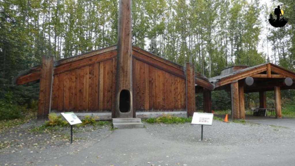
Alaska Native Heritage Route, Anchorage to Seward
The Alaska Native Heritage Route offers a cultural journey through dramatic wilderness landscapes shaped by Indigenous traditions and coastal history. Stretching from Anchorage toward the coastal town of Seward, this route blends towering mountains, glacial valleys, and cultural centers that highlight the heritage of Alaska Native communities. The drive feels expansive and peaceful, with snowcapped peaks rising above turquoise lakes and dense evergreen forests.
Early in the day, fog often settles over the valleys, creating a soft atmosphere that feels almost otherworldly. As the sun rises higher, the scenery transforms into a vibrant display of glaciers, waterfalls, and ocean views. Cultural stops along the way share stories of traditional hunting practices, art, and storytelling that connect visitors to the deep history of the region. Handmade carvings, woven baskets, and dance performances offer insight into traditions that continue to thrive today.
Pull off points along the highway reveal breathtaking views of Turnagain Arm, where tides shift dramatically and wildlife such as beluga whales occasionally appear. Travelers often pause at small coastal towns where wooden buildings face the sea and fishing boats line the harbor. The route encourages slow exploration, allowing visitors to experience both the wild beauty of Alaska and the cultural traditions rooted in the land.
Coordinates: Approximate location 60.7200° N, 149.9003° W near Seward, Alaska
Best Photography Spots:
- Turnagain Arm viewpoints: Capture dramatic reflections of mountains and shifting tides.
- Glacial valleys: Wide landscape shots emphasize scale and untouched wilderness.
- Cultural heritage centers: Colorful artwork and carvings add storytelling depth to photos.
- Coastal harbors: Early morning scenes with fishing boats create peaceful imagery.
- Mountain passes: Misty peaks framed by winding roads offer cinematic perspectives.
Weather conditions can change quickly, so using weather sealed gear and planning for soft natural light helps achieve the best results.
Why It Is So Special
- The Alaska Native Heritage Route stands out because it blends cultural education with some of the most dramatic scenery in North America. Unlike typical tourist highways, this journey highlights Indigenous voices and traditions while encouraging respect for the land. Travelers often describe feeling both small and inspired as they witness glaciers, oceans, and mountains alongside cultural stories that stretch back thousands of years. The experience feels deeply personal, offering a sense of connection to nature and heritage that stays long after the journey ends.
Weather: Cool summers, chilly coastal winds, snowy winters
Best Season to Visit: Late spring through early fall for accessible roads and clear views
Budget: $120 to $220 per night nearby
Best Food Nearby: Fresh salmon, halibut dishes, hearty chowders at coastal restaurants
Best Places to Stay: Seaside lodges in Seward, wilderness cabins, boutique inns in Anchorage
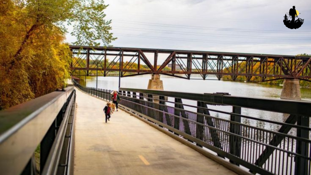
Blackstone River Valley Heritage Corridor, Massachusetts to Rhode Island
Blackstone River Valley Heritage Corridor feels like a quiet journey through the birthplace of the American Industrial Revolution. This historic route follows the Blackstone River, linking mill towns, canals, and preserved factory villages that tell the story of early American industry and innovation. Walking or driving along the corridor reveals red brick buildings, restored waterways, and scenic bike paths that blend natural beauty with cultural history.
Early mornings in the valley feel calm and reflective. Fog often rises gently above the river, softening the outlines of old mill structures and wooden bridges. As sunlight reaches the water, reflections of historic buildings create a timeless atmosphere that feels both nostalgic and peaceful. Many travelers explore sections of the corridor by bicycle or on foot, stopping at small museums that share stories of immigrant communities and the evolution of textile manufacturing.
Local towns along the corridor have transformed historic spaces into cafes, art studios, and community markets. The sound of rushing water from restored canals adds a sense of movement, reminding visitors of the region’s industrial past. Each stop along the route feels like a chapter in a larger story about innovation, resilience, and cultural exchange.
Coordinates: Approximate location 42.0987° N, 71.5073° W near Woonsocket, Rhode Island
Best Photography Spots:
- Historic mill complexes: Capture textured brick facades glowing during golden hour.
- Canal towpaths: Leading lines along water create strong visual depth.
- Stone bridges: Frame reflections in calm river sections for symmetrical compositions.
- Riverside parks: Soft morning light highlights greenery against industrial backdrops.
- Bike trails through forests: Natural pathways contrast beautifully with historic structures.
A tripod helps capture long exposures of flowing water along the canal, especially during early morning light when crowds are minimal.
Why It Is So Special
- Blackstone River Valley Heritage Corridor stands out because it connects nature and industry in a thoughtful way. Instead of presenting history only through museums, the route allows visitors to walk through living landscapes shaped by generations of workers and innovators. Travelers often find themselves reflecting on how technology and community evolved together. The quiet pace of the valley makes it easy to imagine life during the early industrial era while enjoying modern comforts in revitalized towns.
Weather: Cool winters, warm summers, colorful autumn foliage
Best Season to Visit: Late spring and fall for comfortable weather and scenic views
Budget: $90 to $170 per night nearby
Best Food Nearby: New England seafood, clam chowder, artisan bakery treats in historic towns
Best Places to Stay: Boutique inns, restored mill loft hotels, cozy bed and breakfasts

Selma to Montgomery National Historic Trail, Alabama
Selma to Montgomery National Historic Trail carries powerful cultural and historical significance. This route follows the path of the 1965 voting rights marches, guiding travelers through landscapes that played a crucial role in the American civil rights movement. Driving or walking along sections of the trail feels deeply meaningful, as interpretive markers and preserved landmarks share stories of courage, struggle, and change.
In the quiet morning hours, the Alabama countryside appears calm and expansive. Rolling fields stretch toward the horizon, and historic churches stand as silent witnesses to history. As you approach Selma, the Edmund Pettus Bridge rises over the Alabama River, its steel arches creating a striking visual reminder of the events that shaped the nation. Visitors often pause here to reflect, taking in the peaceful surroundings while learning about the movement that unfolded decades ago.
Along the route, small towns host museums and cultural centers that honor activists and local communities. Murals, memorials, and storytelling exhibits create an immersive experience that connects visitors to the voices of the past. The trail is not only about history. It is also about resilience and hope, reminding travelers of the importance of cultural heritage and collective memory.
Coordinates: Approximate location 32.3792° N, 86.3077° W near Montgomery, Alabama
Best Photography Spots:
- Edmund Pettus Bridge viewpoint: Capture dramatic angles of the bridge structure at sunrise.
- Historic churches: Simple architecture framed by open skies creates powerful imagery.
- Rural highway stretches: Leading lines symbolize the journey and historical movement.
- Civil rights memorials: Close up compositions highlight textures and inscriptions.
- Downtown Montgomery streets: Historic buildings and murals tell visual stories of the past.
Soft natural light enhances the emotional tone of photographs here, especially during early morning or late afternoon.
Why It Is So Special
- Selma to Montgomery National Historic Trail is more than a scenic drive. It represents a defining moment in American history and invites visitors to engage with stories of justice and perseverance. Travelers often describe feeling a deep emotional connection to the route, as each stop encourages reflection on the ongoing journey toward equality. The trail blends education with quiet landscapes, offering an experience that feels both meaningful and transformative.
Weather: Warm summers, mild winters
Best Season to Visit: Spring and fall for comfortable temperatures
Budget: $70 to $140 per night nearby
Best Food Nearby: Southern comfort food, fried chicken, collard greens, homemade pies
Best Places to Stay: Historic inns in Selma, boutique hotels in Montgomery, countryside lodges
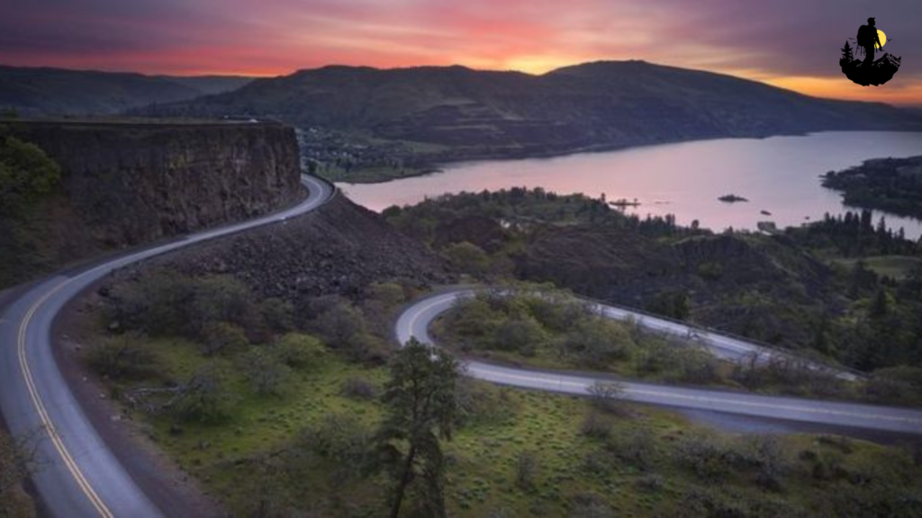
Historic Columbia River Highway, Oregon
Historic Columbia River Highway winds through the Columbia River Gorge, combining breathtaking scenery with early twentieth century engineering and cultural heritage. Designed as one of America’s first scenic highways, the route features stone bridges, historic viewpoints, and access to waterfalls that cascade through lush Pacific Northwest forests. Driving along the road feels cinematic, with sweeping river views and moss covered cliffs creating a timeless atmosphere.
Morning mist often drifts across the gorge, softening the outlines of waterfalls and evergreen trees. As sunlight breaks through the clouds, the river glimmers far below, reflecting shades of blue and silver. Travelers frequently stop at historic overlooks built from natural stone, where panoramic views stretch across dramatic canyon walls. Small towns along the route offer art galleries, local coffee shops, and artisan markets that reflect the creative spirit of the region.
Walking short trails from the highway reveals hidden viewpoints and quiet forest paths. The sound of rushing water echoes through the gorge, blending with birdsong and the gentle rustle of wind through cedar trees. Every curve in the road reveals another perspective of the river, making the journey feel constantly evolving.
Coordinates: Approximate location 45.5607° N, 122.1728° W near Hood River, Oregon
Best Photography Spots:
- Vista House overlook: Capture sweeping panoramic views of the Columbia River Gorge.
- Stone arch bridges: Frame classic architectural details surrounded by forest.
- Waterfall viewpoints: Long exposure shots create silky water effects.
- Cliffside curves: Leading road lines add dynamic movement to landscape photos.
- Riverbank trails: Reflections of cliffs and sky create balanced compositions.
A tripod and neutral density filter are ideal for photographing waterfalls and misty landscapes during overcast conditions.
Why It Is So Special
- Historic Columbia River Highway stands out because it blends cultural history with natural beauty in a way that feels harmonious. The road itself is a historic landmark, designed to showcase the landscape rather than dominate it. Travelers often describe feeling inspired by the balance between human craftsmanship and the raw power of nature. The journey encourages slow exploration, allowing visitors to appreciate both engineering heritage and the timeless beauty of the Pacific Northwest.
Weather: Cool and misty winters, mild summers
Best Season to Visit: Late spring through early fall for accessible trails and clear views
Budget: $100 to $190 per night nearby
Best Food Nearby: Pacific Northwest cuisine, fresh salmon, artisan coffee, farm to table dining
Best Places to Stay: Riverside lodges, boutique hotels in Hood River, forest cabins near the gorge
Santa Fe Trail Scenic Byway, Kansas to New Mexico
Santa Fe Trail Scenic Byway carries the spirit of exploration and cultural exchange that shaped the American Southwest. Once a vital trade route connecting Missouri to Santa Fe, this historic pathway now stretches through open prairies, desert landscapes, and historic towns that still echo with stories of traders, travelers, and Indigenous communities. Driving along the byway feels expansive and peaceful, as endless horizons meet big skies that change color throughout the day.
In the early morning, the plains feel almost silent. Tall grasses sway gently in the wind, and old wagon ruts preserved along sections of the trail offer a tangible connection to the past. Small towns along the route showcase adobe buildings, historic forts, and trading posts that reveal how cultures blended through commerce and migration. Travelers often pause at interpretive sites where wooden signs describe the hardships and hopes of those who traveled west centuries ago.
As the trail moves toward New Mexico, the scenery shifts from prairie to desert mesas. Earth toned cliffs rise against brilliant blue skies, and roadside markets display handcrafted jewelry, pottery, and textiles inspired by regional traditions. The journey feels immersive rather than rushed. Each mile invites curiosity, encouraging visitors to imagine the rhythm of wagon wheels crossing the same landscapes long before modern highways existed.
Coordinates: Approximate location 37.6894° N, 97.3361° W near Wichita, Kansas
Best Photography Spots:
- Historic wagon ruts: Capture textured lines disappearing into the prairie horizon.
- Adobe trading posts: Warm earth tones glow beautifully during sunset.
- Open prairie landscapes: Wide angle shots emphasize the scale of the trail.
- Desert mesa viewpoints: Golden hour light creates dramatic shadows and depth.
- Historic fort ruins: Close up details highlight weathered wood and stone textures.
Using a polarizing filter enhances sky contrast and brings out subtle color variations in prairie grass and desert terrain. Sunrise and sunset provide the softest, most atmospheric light.
Why It Is So Special
- Santa Fe Trail Scenic Byway stands out because it represents a true cultural crossroads. The route reflects Indigenous heritage, Spanish influence, and early American expansion, all woven together through trade and travel. Unlike crowded tourist routes, it encourages slow exploration and meaningful stops where history feels alive rather than distant. Travelers often feel a sense of connection to the resilience and determination of those who once crossed these lands. The blend of wide open landscapes and historic landmarks creates an experience that feels both reflective and inspiring.
Weather: Hot summers, cool spring mornings, crisp autumn evenings
Best Season to Visit: Spring and fall for comfortable temperatures and clear skies
Budget: $70 to $150 per night nearby
Best Food Nearby: Southwestern cuisine, green chile burgers, traditional Mexican dishes at roadside diners
Best Places to Stay: Historic inns in Dodge City, adobe style hotels in Santa Fe, quiet prairie lodges
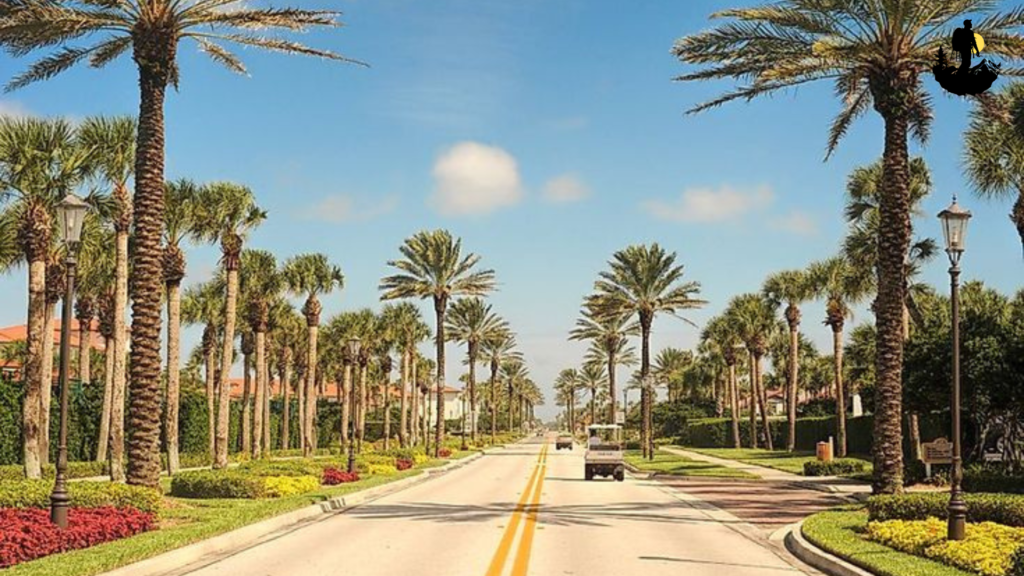
A1A Scenic and Historic Coastal Byway, Florida
A1A Scenic and Historic Coastal Byway follows Florida’s Atlantic coastline, offering a unique blend of maritime heritage, Spanish colonial history, and relaxed beach culture. The road winds past historic lighthouses, centuries old forts, and charming seaside towns where ocean breezes carry the scent of saltwater and blooming coastal flowers. Driving along this route feels refreshing and vibrant, as turquoise waves crash gently against sandy shores and pelicans glide across the sky.
Sunrise along the byway is especially magical. Soft pastel colors reflect on the ocean’s surface while fishing boats drift quietly near the horizon. Historic districts like St. Augustine reveal cobblestone streets and Spanish style architecture that transport visitors back hundreds of years. Small art galleries, coastal cafes, and open air markets bring a lively yet relaxed energy to the journey. The sound of waves accompanies much of the drive, creating a calming rhythm that encourages travelers to slow down.
Further along the coast, the road passes through protected dunes and wildlife areas where sea oats sway in the wind. Wooden boardwalks lead to hidden beaches that feel peaceful even during busier seasons. Travelers often stop at historic forts overlooking the water, where cannons and stone walls stand as reminders of Florida’s colonial past. The combination of ocean scenery and cultural heritage makes the route feel both scenic and deeply historical.
Coordinates: Approximate location 29.8947° N, 81.3145° W near St. Augustine, Florida
Best Photography Spots:
- Historic lighthouse viewpoints: Capture sweeping ocean panoramas during sunrise.
- Spanish colonial streets: Colorful facades and balconies create vibrant compositions.
- Beach dunes: Natural textures of sand and grass add depth to landscape shots.
- Coastal boardwalks: Leading lines guide the viewer toward the sea.
- Sunset pier scenes: Silhouettes of fishermen and seabirds create dramatic imagery.
A neutral density filter helps capture soft, dreamy ocean waves during long exposure photography, especially during golden hour.
Why It Is So Special
- A1A Scenic and Historic Coastal Byway stands out because it combines coastal beauty with centuries of cultural history. From Spanish colonial landmarks to modern beach communities, the route reflects how diverse influences shaped Florida’s identity. Travelers often describe feeling both relaxed and inspired as they move between historic towns and quiet natural beaches. The road encourages spontaneous stops, whether for fresh seafood at a seaside cafe or a peaceful walk along the shoreline. It is a journey where history, culture, and ocean scenery blend into a memorable coastal experience.
Weather: Warm sunny climate with ocean breezes
Best Season to Visit: Winter through spring for pleasant temperatures and clear skies
Budget: $120 to $220 per night nearby
Best Food Nearby: Fresh seafood, shrimp tacos, key lime pie at beachfront restaurants
Best Places to Stay: Oceanfront resorts, historic inns in St. Augustine, boutique beachside hotels
Travel Tips for Exploring Hidden Cultural Trails and Heritage Routes in the USA
Plan for Slow and Meaningful Travel
Hidden heritage routes are not designed for rushing from one stop to another. Many of these trails carry historical depth and cultural significance that reveal themselves gradually. Plan shorter daily distances so you have time to explore small towns, museums, and scenic viewpoints. Slow travel allows you to notice local details such as architecture, storytelling plaques, and community traditions that are easy to miss when traveling quickly.
Research Cultural Etiquette Before Visiting
Many heritage routes pass through Indigenous lands, historic communities, or sacred cultural sites. Learning basic etiquette before your trip shows respect for local traditions and helps you connect more deeply with the experience. Follow posted guidelines, ask permission before photographing people or cultural events, and treat historic landmarks with care. Responsible travel helps preserve these routes for future generations.
Visit Early Morning or Late Afternoon
Lighting conditions and atmosphere can completely transform a heritage trail. Early mornings often feel peaceful and authentic, especially in historic districts or rural landscapes. Late afternoons and golden hours provide softer light that enhances photography while creating a calmer environment. Visiting during quieter times also helps you appreciate the cultural significance without heavy crowds.
Support Local Businesses Along the Route
Hidden trails thrive because of local communities that preserve traditions through food, art, and storytelling. Instead of relying on chain restaurants or large hotels, consider dining at family owned cafes, shopping at artisan markets, and staying in small inns or lodges. This approach not only enriches your travel experience but also helps sustain the cultural identity of the places you visit.
Pack for Changing Landscapes and Weather
Heritage routes often cross diverse environments such as deserts, forests, coastal regions, and mountain areas. Comfortable walking shoes, layered clothing, and sun protection are essential. Bring a reusable water bottle and a small daypack for exploring historic sites or short walking trails. Being prepared for shifting weather conditions ensures you can focus on the journey rather than unexpected discomfort.
Learn the Story Behind Each Destination
What makes cultural trails special is the history woven into every location. Before arriving, spend time reading about the trail’s background or listening to local audio guides. Understanding the context behind historic landmarks adds emotional depth to your visit. Instead of simply seeing a site, you begin to understand why it matters and how it shaped the region’s identity.
Take Time to Disconnect and Reflect
Many hidden heritage routes offer a sense of calm that contrasts with busy city travel. Limited cell service in some areas can actually become a gift, encouraging you to focus on the surroundings. Use this time to reflect, journal, or simply observe the landscape. These moments often become the most memorable parts of a cultural journey.
Conclusion
Hidden cultural trails and heritage routes across the United States offer more than scenic drives or beautiful landscapes. They create opportunities to experience history as something living and evolving rather than something confined to museums. Each route carries stories shaped by Indigenous traditions, early settlers, artistic communities, and local cultures that continue to influence modern life. Traveling these paths invites you to slow down and listen to the voices of the past while appreciating the natural beauty that surrounds them.
Unlike popular tourist destinations, heritage routes encourage meaningful exploration. Small towns, historic landmarks, and local traditions create an atmosphere that feels personal and authentic. Whether you are walking through an old trading post, driving along a quiet scenic byway, or standing at a site that changed the course of history, these experiences often leave a deeper emotional impact than typical travel stops. They remind us that travel is not only about reaching a destination but about understanding the stories that shape each place.
By choosing to explore hidden cultural trails, travelers become part of a larger journey of preservation and appreciation. Supporting local communities, respecting cultural traditions, and traveling thoughtfully ensures that these routes remain vibrant for future explorers. In the end, heritage travel is about connection. It connects landscapes with history, people with traditions, and travelers with a sense of discovery that goes far beyond the surface.
🌿 Sources & References
- Travel & Adventure – National Geographic
- Outdoor Recreation – REI Expert Advice
- Leave No Trace Principles
- Nature Conservation – WWF
- U.S. National Parks – NPS
- Sustainable Tourism – UNWTO
- Wilderness Safety – American Red Cross
- Outdoor Health Benefits – NIH
- Travel Health – CDC
- Ecotourism – The International Ecotourism Society