Forgotten Communities & Rural Life in America
Across the United States, countless small towns and remote settlements quietly hold stories that rarely make headlines. These forgotten communities reflect a slower pace of life shaped by farmland, mountains, rivers, and traditions passed down through generations.
Far from busy cities, they offer a glimpse into authentic rural America where neighbors know each other by name and landscapes remain largely unchanged. Exploring these rural america travel stories and places is not just about travel. It is about understanding resilience, heritage, and the beauty of simplicity that continues to define rural life even as the modern world moves faster around it.
The Hidden Side of America Most Travelers Never See

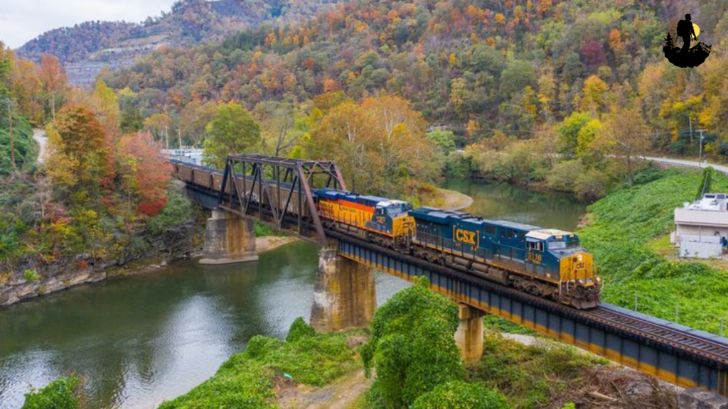
Letchworth Hollow, New York
Letchworth Hollow feels like a hidden chapter tucked within the rolling countryside of western New York. Located near the dramatic cliffs and deep gorges of Letchworth State Park, this rural community moves to the rhythm of seasons rather than schedules. Wooden farmhouses sit along winding roads, their porches decorated with rocking chairs and hand-painted signs. Early mornings begin with fog rising from the Genesee River valley, softening the landscape into muted shades of blue and green.
The area has long been shaped by farming traditions. Small dairy barns and cornfields stretch toward the horizon, while local markets sell homemade jams, maple syrup, and freshly baked pies. Residents here value self-sufficiency, repairing old tractors, growing backyard gardens, and gathering at town halls for seasonal festivals. Autumn transforms the hollow into a fiery canvas of orange and gold, and winter blankets the valley in silence broken only by the crunch of boots on snow.
Walking through Letchworth Hollow feels like stepping back in time. General stores still display wooden barrels filled with candy, and church bells echo across the hills every Sunday morning. The sense of community is strong, with neighbors often helping each other during harvest season or after heavy snowfall. Visitors quickly notice that conversations linger longer, and strangers are greeted with warm curiosity rather than rush.
Coordinates: Approximate location 42.5850° N, 78.0500° W, near Letchworth State Park, western New York
Best Photography Spots:
- Morning overlook above the valley: Captures mist rising through farmland and distant cliffs.
- Old red barn at County Road bend: Perfect for classic rural Americana imagery during golden hour.
- Riverside trail: Frames wooden fences and grazing cattle against the rolling hills.
- Autumn foliage ridge: Best visited late afternoon when sunlight enhances fall colors.
- Tripods work well for sunrise shots when the fog moves slowly through the hollow.
Why It Is So Special
Letchworth Hollow stands out because it preserves a lifestyle built around connection to land and community. Unlike larger tourist towns, it has remained largely untouched by commercial development. Families who have lived here for generations maintain traditions such as barn dances, maple sugaring, and shared harvest meals. The quiet beauty of everyday life becomes the main attraction. Travelers often find themselves slowing down, sipping coffee on a porch, and listening to stories from locals who remember decades of changing seasons. The simplicity creates a sense of peace that feels increasingly rare.
Life here reflects a balance between resilience and tradition. Harsh winters test the community, yet they also strengthen bonds as neighbors check on one another and share resources. Summer evenings bring fireflies across open fields, reminding visitors that rural America is not just a place but a feeling rooted in patience and appreciation for small moments.
Weather: Cold winters with snow, warm summers, colorful autumns
- Best Season to Visit: Late September through October for foliage or late spring for green landscapes
- Budget: $80 to $160 per night in nearby countryside inns
- Best Food Nearby: Homemade apple pies, farm fresh cheeses, maple glazed dishes at small-town diners
- Best Places to Stay: Rustic bed and breakfasts near Mount Morris, family owned farm stays, quiet countryside cottages
Terlingua Ghost Settlement, Texas
Terlingua sits on the edge of the Chihuahuan Desert, where rugged mountains meet endless sky and time feels suspended between past and present. Once a bustling mercury mining town, it now exists as a small, resilient community that blends history with artistic spirit. Weathered adobe ruins stand beside colorful trailers and hand-built homes, creating a landscape that tells stories of hardship, survival, and creativity.
Sunrise over Terlingua paints the desert in shades of pink and gold. The air feels dry and wide open, carrying the faint scent of creosote after rare desert rains. Local residents include ranchers, artists, musicians, and travelers who came for a short visit but never left. Evenings often bring gatherings around outdoor fire pits, with guitars playing softly as the sky fills with stars brighter than most people have ever seen.
Life here revolves around independence. Water is precious, supplies are carefully managed, and many homes rely on solar power. The historic Terlingua cemetery stands quietly on a hill, its white crosses reflecting decades of stories from miners and families who built a life in this remote region. Despite the harsh environment, a strong sense of belonging defines the community. Small cafes serve chili and homemade tortillas, and festivals like the annual chili cookoff draw visitors from around the world while still feeling local at heart.
Walking through the ghost settlement reveals a contrast between decay and renewal. Old stone walls crumble under desert winds, yet murals and handmade art bring bursts of color to the landscape. The silence here is not empty but expansive, giving travelers time to reflect while watching distant mountains change color with the setting sun.
Coordinates: Approximate location 29.3200° N, 103.6100° W, near Big Bend National Park, Texas
Best Photography Spots:
- Terlingua cemetery hilltop: Offers sweeping views of desert plains and distant mountains at sunset.
- Abandoned mining ruins: Perfect for capturing textures of weathered stone against dramatic skies.
- Ghost town main street: Colorful art installations and rustic buildings create unique compositions.
- Night sky vantage point: Ideal for long exposure astrophotography due to minimal light pollution.
- A sturdy tripod and wide lens help capture the vast desert landscape.
Why It Is So Special
Terlingua embodies the spirit of forgotten America through its blend of resilience and reinvention. The town survived economic collapse when mining ended, yet its residents transformed hardship into creativity. Artists turned abandoned structures into studios, musicians brought life back to empty streets, and travelers discovered a place where authenticity outweighs comfort. The desert landscape encourages introspection, and many visitors describe feeling a deep connection to nature and history during their stay.
Unlike polished tourist destinations, Terlingua remains raw and genuine. The lack of large infrastructure preserves its quiet charm, allowing visitors to experience true rural isolation. Nights filled with starlight, conversations with locals, and the haunting beauty of old ruins create memories that linger long after leaving. It is a reminder that even in the harshest environments, community and creativity can thrive.
The settlement also reflects the changing identity of rural America. While traditional ranching culture still exists, new generations bring art, storytelling, and sustainable living practices. This blend of old and new gives Terlingua a unique character that feels both timeless and evolving.
Weather: Hot desert summers, mild winters, cool nights year round
- Best Season to Visit: November through March for comfortable temperatures and clear skies
- Budget: $70 to $140 per night for desert cabins or rustic casitas
- Best Food Nearby: Texas chili, handmade tortillas, smoky barbecue from local roadside kitchens
- Best Places to Stay: Adobe style casitas, desert glamping sites, small guesthouses overlooking Big Bend landscapes
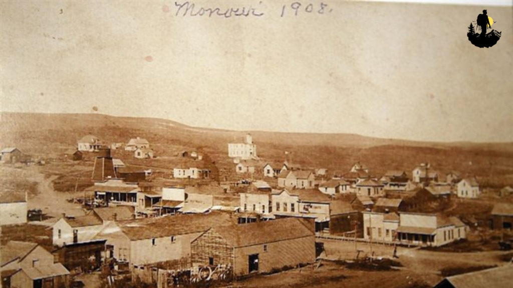
Monowi, Nebraska
Monowi is often described as one of the smallest communities in America, yet its story represents the enduring spirit of rural life on the Great Plains. Surrounded by endless stretches of prairie grass and open sky, this tiny settlement carries a quiet resilience shaped by decades of change. Old grain silos stand tall against the horizon, reminders of a time when rail lines and farming families brought more activity to the region. Today, weathered buildings and wide gravel roads give Monowi a peaceful, almost timeless atmosphere.
Mornings here begin with sunlight spilling across golden fields, while the sound of wind moving through tall grass replaces the noise of traffic. The pace of life is slow and deliberate. Locals focus on maintaining traditions, preserving local history, and welcoming curious travelers who arrive to experience a place that feels far removed from modern city life. The nearby Niobrara River valley offers rolling hills and wildlife sightings, adding natural beauty to the quiet setting.
Despite its size, Monowi has become a symbol of perseverance. The remaining residents continue to operate small businesses and maintain community landmarks, creating a sense of pride that draws visitors from around the world. Conversations often unfold over coffee at a simple counter, where stories about farming seasons and changing weather patterns flow easily. Evenings bring spectacular sunsets that stretch across the prairie, turning the sky into shades of crimson and gold.
Coordinates: Approximate location 42.8300° N, 98.3300° W, northern Nebraska near the South Dakota border
Best Photography Spots:
- Prairie horizon viewpoint: Capture vast skies and dramatic sunsets over rolling grasslands.
- Historic grain elevator: A classic rural landmark that reflects the agricultural past of the region.
- Niobrara River overlook: Offers sweeping natural landscapes with wildlife and gentle hills.
- Quiet main street at sunrise: Soft morning light creates nostalgic rural scenes.
- Using a tripod helps highlight long shadows during golden hour.
Why It Is So Special
Monowi stands out because it represents the resilience of America’s smallest communities. While many rural towns faded as populations shifted toward cities, Monowi adapted by embracing its identity rather than trying to compete with urban life. Visitors often feel a deep sense of calm here, where simplicity replaces constant noise. The town’s quiet character invites reflection and encourages travelers to appreciate small details such as handwritten signs, old wooden fences, and wide open skies.
What makes Monowi truly unique is its ability to preserve history while remaining welcoming to newcomers. The stories shared by locals create a living museum of rural traditions, from farming practices to community gatherings. For travelers seeking authenticity, Monowi offers an experience that feels deeply personal and genuine, reminding visitors that even the smallest places can hold powerful stories.
Weather: Cold winters with strong winds, warm sunny summers
- Best Season to Visit: Late spring through early fall for comfortable weather and green prairie views
- Budget: $60 to $120 per night in nearby small towns
- Best Food Nearby: Homemade pies, hearty Midwestern comfort meals, classic diner breakfasts
- Best Places to Stay: Farm stays near Lynch, small roadside motels, countryside guesthouses
Elkhorn City, Kentucky
Tucked deep within the Appalachian Mountains, Elkhorn City reflects the rich cultural heritage and challenges of rural coal country. Narrow roads wind through forested hills, leading to a town where front porches overlook railroad tracks and the Russell Fork River flows steadily through the valley. The surrounding mountains create a sense of shelter and isolation, shaping a community that relies heavily on tradition and close relationships.
Life here is deeply connected to nature. Residents fish along rocky riverbanks, hike through dense forests, and gather at local events that celebrate Appalachian music and storytelling. The town’s historic downtown features small shops, local diners, and murals honoring miners who once powered the regional economy. Though industries have changed, the sense of pride remains strong, reflected in community festivals and family gatherings that bring people together year after year.
Autumn transforms Elkhorn City into a vibrant landscape filled with fiery foliage, while spring brings blooming wildflowers and fresh mountain air. Early mornings reveal mist drifting between ridges, creating scenes that feel almost cinematic. The slower pace allows visitors to appreciate simple moments such as a conversation with a shop owner or the sound of a train echoing through the valley.
Coordinates: Approximate location 37.3000° N, 82.3500° W, eastern Kentucky near the Virginia border
Best Photography Spots:
- Breaks Interstate Park overlook: Dramatic views of Appalachian cliffs and winding rivers.
- Russell Fork River bridge: Perfect for capturing reflections and mountain backdrops.
- Historic downtown murals: Add cultural storytelling to travel photography.
- Autumn ridge trail: Best during peak foliage when mountains glow with color.
- Morning fog often creates a dreamy atmosphere for landscape shots.
Why It Is So Special
Elkhorn City captures the heart of Appalachian rural life through its music, traditions, and deep-rooted community bonds. While economic shifts have changed the region, the town’s spirit remains resilient. Visitors quickly notice how storytelling plays a central role here, whether through bluegrass music drifting from a porch or local histories shared over a meal. The landscape itself feels alive, with forests and rivers shaping daily life and encouraging outdoor exploration.
The town’s authenticity lies in its ability to preserve cultural identity. Handmade crafts, traditional recipes, and mountain hospitality make travelers feel like part of the community rather than outsiders. Elkhorn City offers a reminder that rural America is not defined by decline but by adaptation and strong cultural roots that continue to inspire new generations.
Weather: Mild summers, cool mountain evenings, colorful autumns
- Best Season to Visit: October for fall foliage or late spring for hiking and river views
- Budget: $70 to $140 per night for cabins or local inns
- Best Food Nearby: Appalachian comfort dishes, fried catfish, homemade biscuits and gravy
- Best Places to Stay: Mountain cabins near Breaks Interstate Park, small family owned motels, riverside lodges
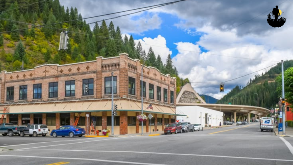
Wallace, Idaho
Hidden within the Bitterroot Mountains of northern Idaho, Wallace is a historic mining town that blends rugged history with a surprisingly vibrant community spirit. Brick buildings line narrow streets, their vintage signs reflecting the town’s silver mining past. Surrounded by dense pine forests and steep mountain slopes, Wallace feels both remote and welcoming, offering a glimpse into rural life shaped by industry and nature.
Morning light filters through tall evergreens, casting long shadows across old storefronts. Locals gather at small cafes to discuss weather, hiking trails, and the latest community events. The town’s historic district has been carefully preserved, creating a sense that time moves differently here. Nearby mountain trails attract cyclists and hikers, while winter transforms the region into a snowy wonderland ideal for quiet escapes.
Wallace has reinvented itself over the years, transitioning from a mining hub to a destination known for outdoor adventure and heritage tourism. Despite the changes, the town maintains its authentic character. Antique shops, local breweries, and museums share stories of resilience, while seasonal festivals bring neighbors together in celebration. Evenings often end with soft mountain breezes and the distant sound of trains passing through the valley.
Coordinates: Approximate location 47.4700° N, 115.9200° W, northern Idaho near the Montana border
Best Photography Spots:
- Historic downtown streets: Capture colorful brick buildings and vintage storefronts.
- Pulaski Tunnel Trail entrance: Combines forest scenery with historical significance.
- Mountain overlook above town: Offers panoramic views of rooftops surrounded by pine forests.
- Winter snow scenes along Silver Valley: Perfect for dramatic seasonal photography.
- Golden hour highlights the textures of old architecture beautifully.
Why It Is So Special
Wallace stands as a testament to how rural communities can evolve while preserving their past. The town’s historic charm creates a strong sense of identity, drawing visitors who appreciate stories woven into every building. Unlike large tourist destinations, Wallace feels personal and approachable. Locals proudly share their history, inviting travelers to explore museums, scenic trails, and small businesses that keep the town alive.
The surrounding wilderness adds another layer of magic. Towering mountains and quiet forests create a peaceful environment that encourages exploration and reflection. Whether visiting in summer for hiking or winter for snow covered landscapes, Wallace offers a balance between adventure and nostalgia. It represents rural America’s ability to adapt without losing its soul, making it a place where history and modern life coexist in harmony.
Weather: Snowy winters, mild summers, crisp mountain air year round
- Best Season to Visit: Summer for outdoor trails or December for snowy scenery
- Budget: $80 to $150 per night for historic inns or mountain lodges
- Best Food Nearby: Hearty mountain fare, smoked meats, local craft brews, homemade desserts
- Best Places to Stay: Historic hotels in downtown Wallace, forest cabins, cozy mountain bed and breakfasts
Caliente, Nevada
Caliente sits quietly in southeastern Nevada, surrounded by desert hills and dramatic red rock formations that glow under the vast western sky. Once an important railroad stop, this small town still carries echoes of its early twentieth century energy. A historic mission style train depot stands as the centerpiece of town, while wide streets and low buildings create an open, sunlit landscape that feels far removed from crowded city life.
Life in Caliente follows the rhythm of desert seasons. Early mornings are cool and peaceful, with locals gathering at diners before heading out to ranches, small businesses, or nearby trails. The surrounding landscape offers a blend of rugged beauty and solitude, from winding canyons to hidden hot springs. In the evening, the desert air cools quickly, and golden light stretches across the valley, turning even simple scenes into striking visual moments.
Community events bring residents together, especially local fairs and outdoor gatherings that celebrate the region’s rural roots. Travelers often find that conversations here unfold naturally, as locals share stories about railroad history, desert storms, and the resilience required to live in such an isolated environment. Caliente’s charm lies in its authenticity, where life feels grounded and unhurried.
Coordinates: Approximate location 37.6100° N, 114.5100° W, southeastern Nevada
Best Photography Spots:
- Historic Caliente Depot: A beautiful example of early railroad architecture against desert skies.
- Kershaw Ryan State Park canyon trail: Captures greenery contrasting with red rock cliffs.
- Sunset overlook above town: Wide desert vistas filled with warm evening light.
- Starry night viewpoints outside town: Ideal for long exposure photography due to clear skies.
- Tripods help capture the dramatic desert light during sunrise and sunset.
Why It Is So Special
Caliente reflects a quieter side of rural Nevada that many travelers overlook. The town’s railroad heritage and surrounding desert landscapes create a strong sense of identity rooted in perseverance. Unlike busier tourist hubs, Caliente offers a peaceful environment where visitors can truly disconnect. The mix of history and natural beauty encourages exploration, from walking through historic streets to hiking remote canyon trails.
Residents maintain a strong sense of community, supporting local events and preserving historic buildings. This dedication keeps the town vibrant despite its small size. Travelers often describe feeling a deep sense of calm here, as the expansive desert horizon invites reflection and appreciation for life’s simpler rhythms.
Weather: Hot summers, mild winters, cool desert nights
- Best Season to Visit: October through April for comfortable temperatures
- Budget: $70 to $130 per night at small motels or desert cabins
- Best Food Nearby: Classic American diner meals, grilled steaks, homemade pies
- Best Places to Stay: Historic railroad style inns, desert lodges, quiet RV parks with scenic views
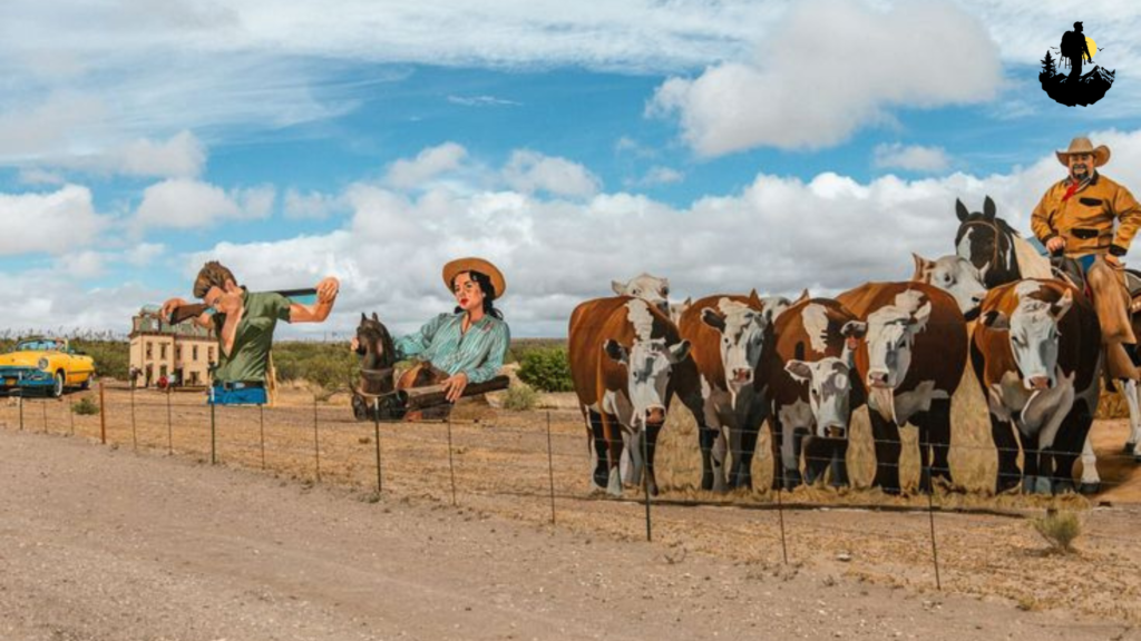
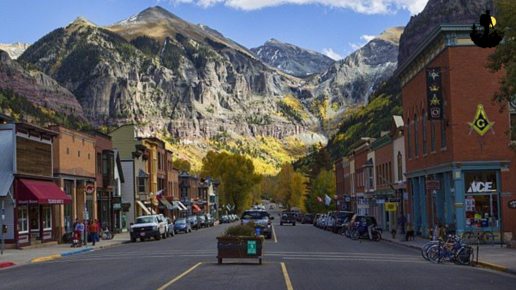
Marfa, Texas
Marfa lies in the remote high desert of West Texas, where minimalist art, ranching culture, and open landscapes blend into a uniquely rural experience. The town’s wide streets and low adobe buildings reflect its frontier history, while contemporary art installations bring an unexpected creative energy. Despite its growing reputation among travelers, Marfa still maintains the slow pace and strong community ties that define rural life.
Sunrise reveals endless desert plains stretching toward distant mountains, and the air carries a quiet stillness that feels almost meditative. Local cafes open slowly, serving fresh coffee and simple meals to ranchers, artists, and visitors alike. The mysterious Marfa Lights have added to the town’s mystique, drawing curious travelers to the desert at night to watch for unexplained glowing orbs on the horizon.
Daily life revolves around creativity and independence. Small galleries, vintage shops, and handmade craft markets highlight the town’s artistic spirit, while nearby ranchlands remind visitors of Marfa’s agricultural roots. Festivals celebrating film, music, and local culture bring energy without overwhelming the town’s peaceful atmosphere.
Coordinates: Approximate location 30.3100° N, 104.0200° W, West Texas desert
Best Photography Spots:
- Marfa courthouse square: Combines historic architecture with desert light.
- Chinati Foundation grounds: Minimalist art structures set against wide landscapes.
- Marfa Lights viewing area: Ideal for night photography and long exposures.
- Open highway outside town: Classic West Texas scenery with dramatic skies.
- A wide angle lens works beautifully to capture the expansive desert environment.
Why It Is So Special
Marfa stands out because it blends rural tradition with modern creativity. While many forgotten communities struggle to attract attention, Marfa embraced its uniqueness, turning isolation into inspiration. The contrast between quiet ranch life and contemporary art gives the town a distinctive character that feels both grounded and innovative.
Visitors often discover that beyond the galleries and art installations lies a warm, welcoming community. Conversations with locals reveal stories about desert living, long distances between towns, and the beauty of solitude. Marfa’s magic comes from its balance between simplicity and imagination, offering travelers a rare opportunity to experience rural America through both artistic and cultural lenses.
Weather: Warm days, cool desert nights, mild winters
- Best Season to Visit: March through May or October for pleasant temperatures
- Budget: $90 to $180 per night depending on boutique stays or simple motels
- Best Food Nearby: Tex Mex dishes, handmade tortillas, local coffee shops and bakeries
- Best Places to Stay: Restored adobe hotels, desert casitas, minimalist boutique inns
Green Bank, West Virginia
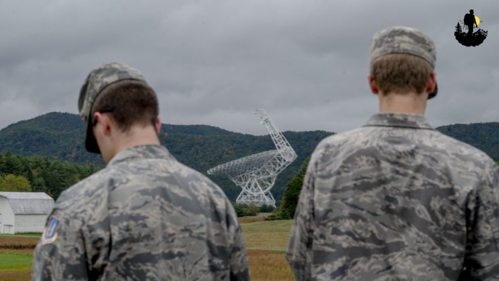
Hidden deep within the mountains of West Virginia, Green Bank is unlike any other rural community in America. Known for its role in scientific research, the town sits within a radio quiet zone where wireless signals are limited to protect sensitive telescopes. This unique environment creates an atmosphere of remarkable silence, allowing visitors to experience a level of calm rarely found in modern life.
Rolling Appalachian hills surround the town, covered in dense forests that change color with each season. The massive radio telescope rises above the valley like a futuristic sculpture, yet daily life remains deeply rooted in rural traditions. Locals farm small plots of land, maintain historic homes, and gather at community events that celebrate Appalachian heritage.
Walking through Green Bank feels peaceful and reflective. Without constant digital noise, visitors often notice subtle sounds such as birdsong, rustling leaves, and distant streams. The slower pace encourages meaningful conversations and a deeper connection to the natural surroundings. Stargazing here is exceptional, as minimal interference creates clear night skies filled with brilliant constellations.
Coordinates: Approximate location 38.4300° N, 79.8300° W, Pocahontas County, West Virginia
Best Photography Spots:
- Green Bank Observatory grounds: Capture the massive telescope framed by mountain scenery.
- Highland Scenic Highway overlooks: Stunning panoramic views of forested ridges.
- Morning fog in surrounding valleys: Creates soft, atmospheric landscapes.
- Night sky viewpoints near Snowshoe area: Ideal for astrophotography.
- Tripods help achieve sharp images in low light conditions.
Why It Is So Special
Green Bank represents a rare blend of science and rural tradition. The radio quiet zone shapes daily life, encouraging residents to live with fewer digital distractions and stronger face to face connections. This unusual balance gives the town a peaceful atmosphere that feels almost timeless. Visitors often find themselves slowing down, noticing details they might normally overlook in a more connected world.
The surrounding Appalachian landscape adds to the town’s charm, offering hiking trails, scenic drives, and a deep sense of natural beauty. Green Bank reminds travelers that rural communities can evolve in unexpected ways while still preserving their heritage. It stands as a testament to how innovation and tradition can coexist, creating a place that feels both unique and deeply rooted in the rhythms of rural America.
Weather: Cool mountain summers, cold winters with occasional snow
- Best Season to Visit: Late spring through early fall for comfortable outdoor exploration
- Budget: $80 to $150 per night at local inns or cabins
- Best Food Nearby: Appalachian comfort meals, farm fresh vegetables, homemade desserts at small cafes
- Best Places to Stay: Mountain lodges, rustic cabins, quiet countryside bed and breakfasts
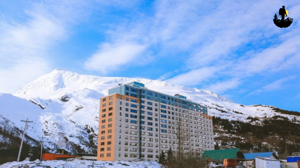
Whittier, Alaska
Whittier is one of the most unusual rural communities in America, tucked between towering mountains and the icy waters of Prince William Sound. Accessible through a long mountain tunnel, the town feels isolated from the outside world, surrounded by glaciers, waterfalls, and dramatic coastal scenery. Most residents live in a single large building known locally as Begich Towers, creating a close knit community where daily life unfolds under one roof while the vast wilderness stretches endlessly outside.
Mornings in Whittier often begin with low clouds drifting through steep cliffs, giving the harbor a misty, almost cinematic atmosphere. Fishing boats rock gently in the marina, and seabirds circle overhead searching for their first catch of the day. The pace of life here is shaped by nature’s rhythm. Weather changes quickly, and residents learn to adapt to strong winds, heavy rain, and long winter nights. Despite the remote setting, the community thrives on cooperation, with neighbors supporting each other during harsh conditions.
The surrounding landscape offers a sense of raw beauty rarely experienced elsewhere. Waterfalls pour down rocky slopes after rainfall, and snow capped peaks reflect in the cold blue water. Kayakers glide quietly across the sound, while hikers explore trails that reveal panoramic views of glaciers and dense coastal forests. During summer, nearly endless daylight fills the town with energy, while winter brings a quieter, reflective mood as darkness settles over the mountains.
Whittier’s history is tied to military development during World War II, and remnants of that era still shape the town’s character. Old bunkers and historic structures stand alongside modern homes, creating a fascinating blend of past and present. Travelers who arrive here often feel like they have discovered a hidden corner of America where nature dominates and community bonds remain strong.
Coordinates: Approximate location 60.7700° N, 148.6800° W, Prince William Sound, Alaska
Best Photography Spots:
- Harbor viewpoint at sunrise: Captures fishing boats framed by misty mountains and calm water.
- Waterfall cliffs near town entrance: Perfect for dramatic long exposure shots after rainfall.
- Prince William Sound shoreline: Reflective water and distant glaciers create stunning compositions.
- Tunnel exit overlook: Offers a unique perspective of the town surrounded by towering peaks.
- A tripod is highly recommended due to low light and frequent cloudy conditions.
Why It Is So Special
Whittier stands out because it redefines what rural life can look like. Instead of wide farmland or desert plains, this community exists within a compact space shaped by extreme geography. Living in such isolation creates a strong sense of unity among residents. People rely on shared resources, friendly conversation, and mutual support to navigate both the challenges and beauty of coastal Alaska.
Visitors often describe feeling humbled by the scale of the surrounding landscape. The mountains feel immense, the ocean endless, and the weather unpredictable. Yet within this wild setting, the town maintains a welcoming atmosphere that reflects the resilience of rural America. The quiet streets, combined with the sound of waves and distant waterfalls, create a peaceful environment that encourages reflection and connection with nature.
Whittier also offers a rare opportunity to experience life without constant distractions. Limited infrastructure and remote surroundings encourage travelers to slow down, observe the changing light across glaciers, and appreciate the simple routines that define daily life. Whether watching fog roll across the harbor or sharing stories with locals at a small cafe, visitors often leave with a deeper appreciation for the strength and simplicity found in forgotten communities.
Weather: Cool summers, heavy rain throughout the year, cold snowy winters
- Best Season to Visit: June through August for long daylight hours and calmer seas
- Budget: $120 to $220 per night for harbor view lodges or small inns
- Best Food Nearby: Fresh Alaskan seafood, salmon chowder, locally caught halibut dishes
- Best Places to Stay: Harborfront guesthouses, small coastal lodges, cozy waterfront cabins
Travel Tips for Exploring Forgotten Communities & Rural Life in America
Plan for Distance and Limited Services
Rural destinations often sit far from major highways or airports, so planning ahead makes a huge difference. Fuel stations, grocery stores, and medical facilities may be spread out across long distances. Before heading into remote regions, map your route, download offline directions, and keep extra water or snacks on hand. These simple preparations help you travel comfortably without stress.
Respect Local Culture and Pace
Forgotten communities thrive on tradition and close relationships. Life moves slower, and visitors who embrace that rhythm often have the best experiences. Take time to talk with locals, support small businesses, and observe community customs. A friendly greeting or genuine curiosity can open the door to meaningful conversations and stories you would never find in a travel guide.
Support Local Economies
Choose family owned diners, local craft shops, and small lodges whenever possible. Rural communities rely heavily on tourism income, and even small purchases help preserve historic towns and cultural traditions. Buying handmade goods or eating at a local cafe creates a more authentic travel experience while giving back to the community you are visiting.
Prepare for Changing Weather and Terrain
Many rural destinations are located in mountains, deserts, or coastal regions where weather can shift quickly. Layered clothing, sturdy footwear, and a basic first aid kit are always useful. Check seasonal conditions before traveling, especially if you plan to hike, photograph landscapes, or explore remote trails.
Slow Down and Be Present
The true beauty of rural America lies in its quiet moments. Instead of rushing between locations, allow time to sit on a porch, watch a sunset, or listen to the sounds of nature. Photography, journaling, or simply walking through town without a strict schedule can help you connect more deeply with the place and its people.
Stay Connected Safely While Disconnecting Digitally
Some communities have limited internet or mobile service. Let someone know your travel plans, and carry printed reservations or directions. While the lack of constant connectivity may feel unusual at first, it often becomes one of the most rewarding aspects of exploring these peaceful destinations.
Conclusion
Forgotten communities and rural towns across America offer more than scenic views. They reveal a way of life shaped by resilience, heritage, and a deep connection to the land. Whether you find yourself in a quiet prairie settlement, a mountain valley, or a desert ghost town, each place carries stories that reflect the heart of the country. These destinations remind travelers that beauty does not always come from grand attractions or crowded landmarks. Sometimes it exists in simple routines, handwritten signs, and conversations shared over a cup of coffee.
Exploring rural life encourages a shift in perspective. The slower pace invites reflection, while the landscapes create space to breathe and appreciate nature’s rhythms. Many visitors leave with a renewed sense of calm, inspired by communities that continue to thrive despite isolation or changing times. By traveling respectfully and supporting local traditions, you help preserve the authenticity that makes these places so meaningful.
Ultimately, journeys through forgotten America are about connection. They connect travelers to history, to people, and to moments that feel genuine and unfiltered. As you explore these quiet corners of the country, remember that the experience is not just about where you go but how you engage with the world around you. When you slow down, listen, and embrace the simplicity of rural life, you discover a side of America that feels timeless, welcoming, and deeply human.
🌿 Sources & References
- Travel & Adventure – National Geographic
- Outdoor Recreation – REI Expert Advice
- Leave No Trace Principles
- Nature Conservation – WWF
- U.S. National Parks – NPS
- Sustainable Tourism – UNWTO
- Wilderness Safety – American Red Cross
- Outdoor Health Benefits – NIH
- Travel Health – CDC
- Ecotourism – The International Ecotourism Society